
Slight severe risk Saturday for central Minnesota, marginal in the Twin Cities.
A few cells could produce high winds and hail Saturday.

Go Deeper.
Create an account or log in to save stories.
Like this?
Thanks for liking this story! We have added it to a list of your favorite stories.


It’s a garden variety rainfall pattern around most of Minnesota overnight into early Saturday.
But the next low-pressure wave moving into Minnesota Saturday has the potential to spark a few strong to possibly severe cells.
NOAA’s Storm Prediction Center paints a slight risk zone for severe storms across most of central Minnesota Saturday. The risk zone includes areas in and around Morris, St. Cloud, Brainerd, Walker, and Hinckley.
If you’re in this zone Saturday, keep an eye out for a few strong to severe storms, and possible watches and warnings.
Turn Up Your Support
MPR News helps you turn down the noise and build shared understanding. Turn up your support for this public resource and keep trusted journalism accessible to all.
A lower marginal risk zone includes the Twin Cities and much of southern Minnesota.
NOAA’s WRF model is one that suggests a possible storm cluster developing around midday in central Minnesota around St. Cloud and racing east toward I-35 between Duluth and the far northern Twin Cities.
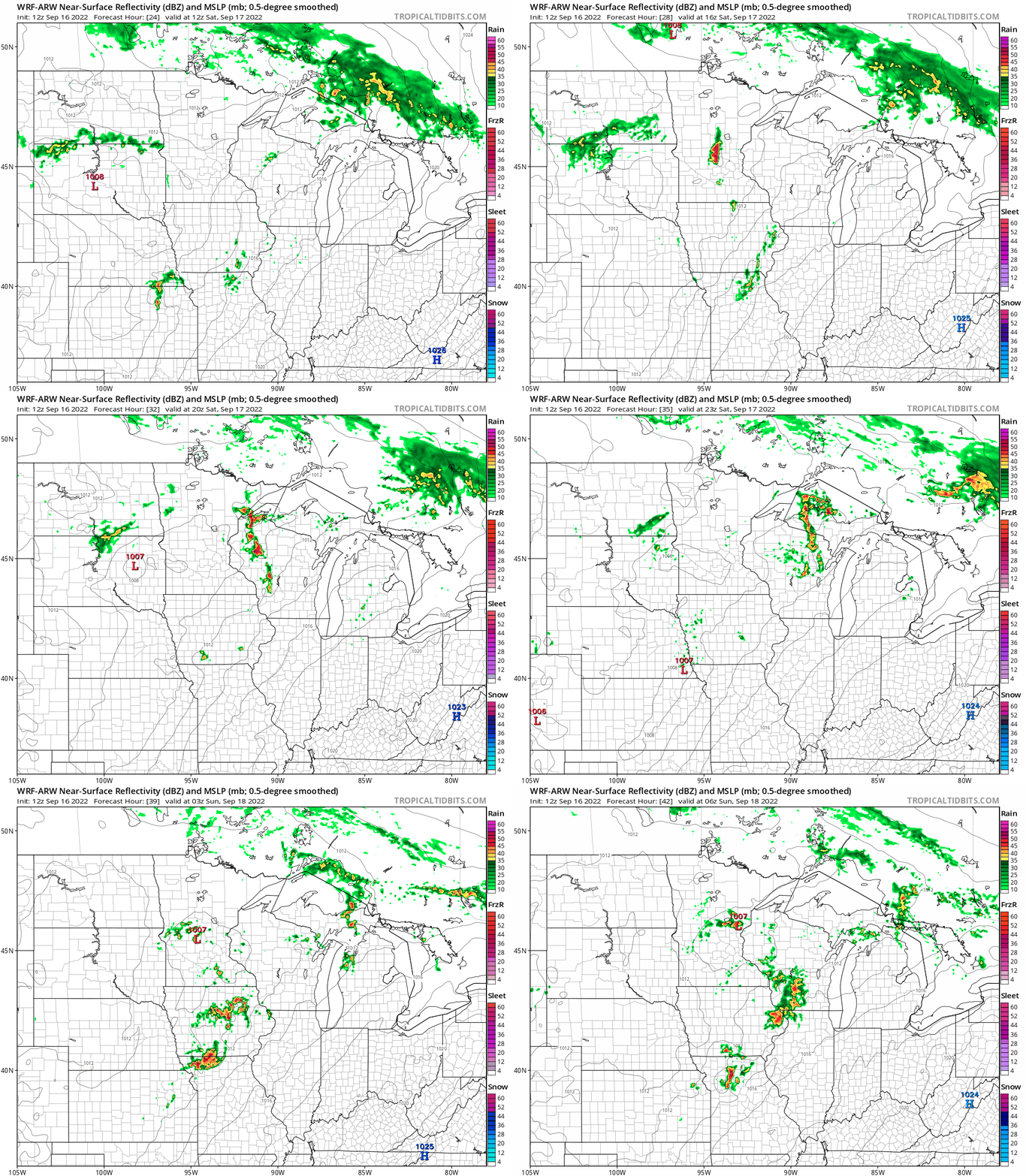
So keep an eye out for possible strong to severe cells Saturday, especially north of the Twin Cities.
Nicer Sunday
Sunday looks like the sunnier, quieter day this weekend. Highs will be near 70 up north and should push to near 80 degrees in southern Minnesota.

Highs in the 80s linger into Monday and Tuesday.

But the season’s strongest cool front appears ready to blow in much cooler air starting next Thursday. Overnight lows look likely to dip into the 40s and even 30s in northern Minnesota late next week. Lows in the chilly 50s (possibly even 40s in the suburbs) will feel a little different for the Twin Cities late next week.

Highs will hover in the 50s north and low 60s south late next week.
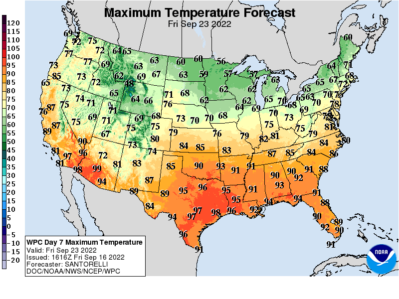
Astronomical fall begins next Thursday at 8:03 pm CDT.
Cooler temperatures are on the way fall weather fans!

