
Possible rain, snow chances through next week
Be ready for an unsettled forecast as we head into next week
Go Deeper.
Create an account or log in to save stories.
Like this?
Thanks for liking this story! We have added it to a list of your favorite stories.


November is here.
That means wild temperature swings are likely. A case in point includes our record temperatures this week.
But as we move deeper into November, the increased frequency of subfreezing air incursions means inbound weather systems can pack snow.
The medium-range forecast models are pretty good at picking up on bigger storms a week or so in advance. The finer details like storm tracks, temperatures and moisture profiles take time to come into finer focus. But we often get a pretty good heads-up on the notion of bigger storm systems a week out.
Turn Up Your Support
MPR News helps you turn down the noise and build shared understanding. Turn up your support for this public resource and keep trusted journalism accessible to all.
So let’s take a longer-range peek at a couple of weather systems into next week.
Friday rain
The first weather system arrives Friday into Saturday. This system will be colder but will feature mostly rain, with a few wet snowflakes possible in the colder air on the backside of the system. The Canadian model seems to have a pretty good handle on the system Friday and Saturday.

Under this scenario, parts of southeastern Minnesota and Wisconsin will see significant rainfall of over an inch.

Rain and snow next week?
Next week features two possible weather systems. The first looks likely to bring scattered rains next Tuesday. The second, a stronger and colder system that’s starting to show up on the forecast maps, could bring a mix of rain and snow to Minnesota by next Thursday.
Check out the National Oceanic and Atmospheric Administration’s Global Forecast System model run, which suggests the second stronger system could wrap up into a more intense low and produce significant snow across parts of western and northern Minnesota.
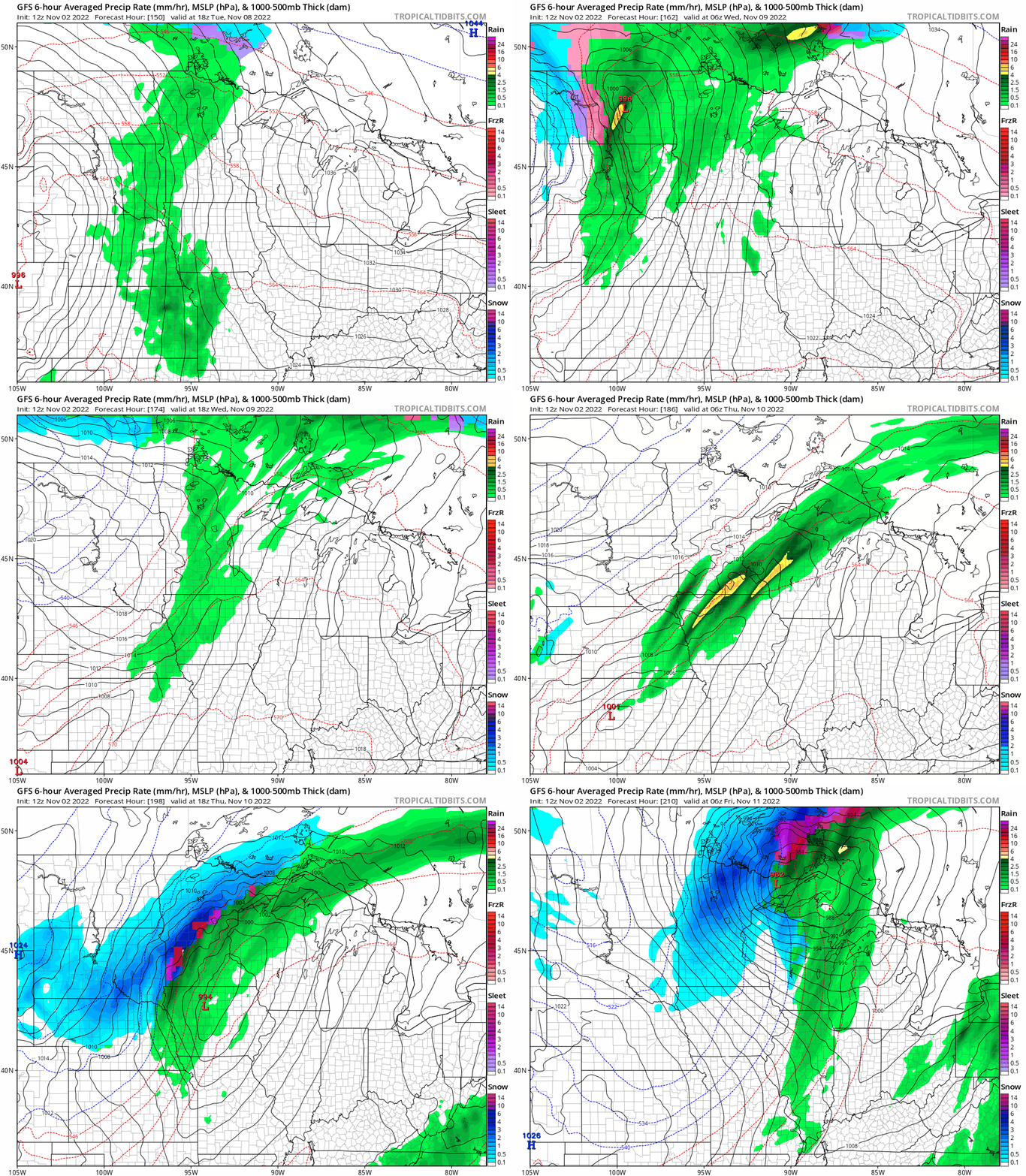
Obviously, track changes can (and probably will) dramatically change precipitation types and coverage, so be ready for a changeable and unsettled forecast as we head into next week.
Forecast model peeping will be a major pastime for meteorologists as we look ahead to next week. The average date for the first inch of snow in the Twin Cities is Nov. 18.
Stay tuned.

