Twin Cities sees wettest winter in 142 years

Minnesota saw a relatively mild meteorological winter, despite a cold start

Two person shoveling
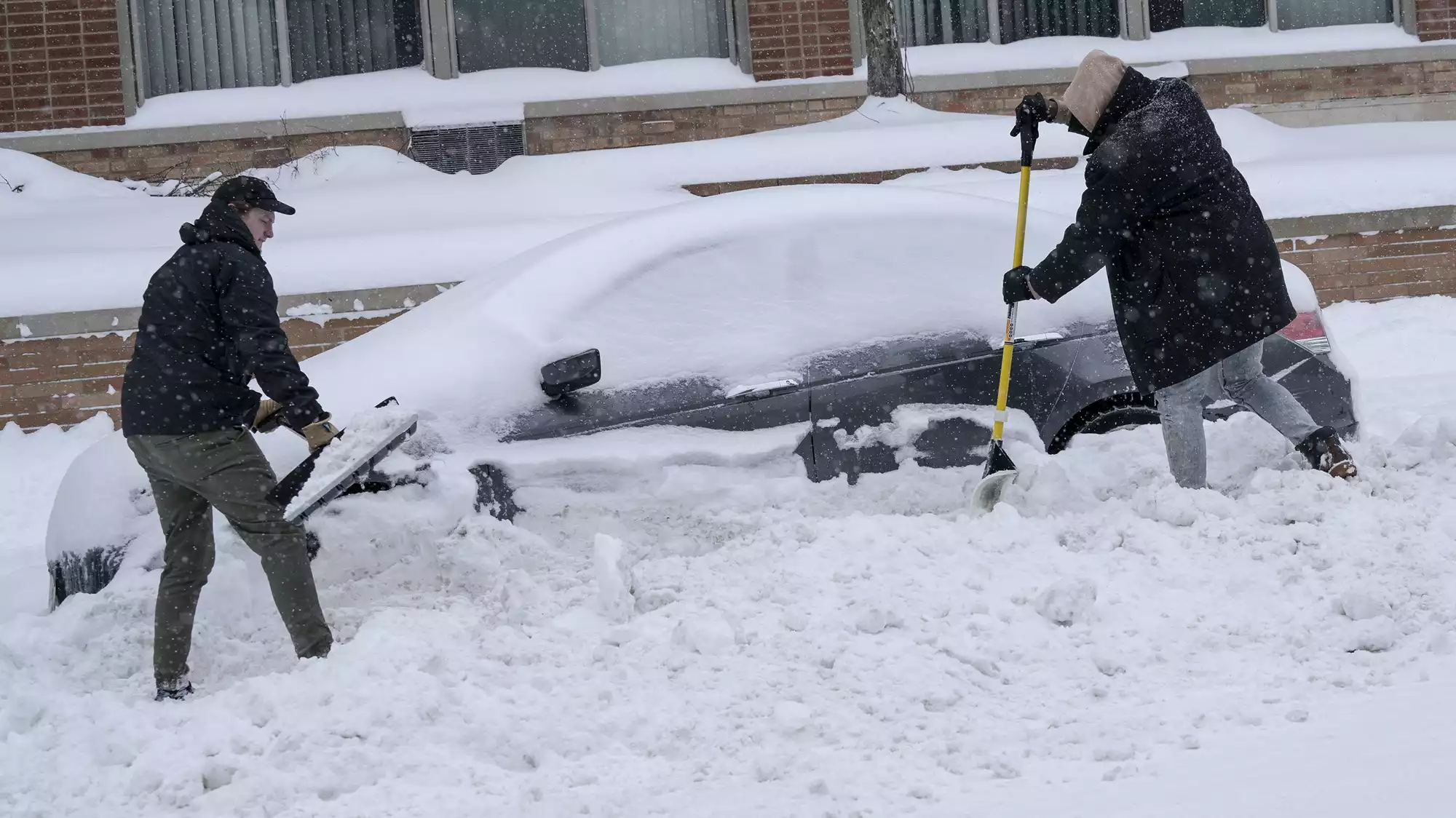
Jake Gunderson, left, helps Joshua James dig his car out of a snowbank Feb. 23 on Lagoon Avenue in Minneapolis. Reliable records say this meteorological winter was the Twin Cities' wettest.
Judy Griesedieck for MPR News

Most Minnesotans will probably recall how snowy it was this winter but it was also very wet overall and relatively mild, despite a cold start.

A very wet winter

Depending on how far back you go in the data, it was either the wettest or second-wettest meteorological (December-January-February) winter for the Twin Cities. Records back to 1893 are considered the most reliable, and in that case this winter was No. 1. (The winter of 1880-1881 measured a whopping 9.58 inches of precipitation.)

precip chart to date
Winter precipitation for the Twin Cities compared to the records and normal
National Weather Service

We received 6.45 inches of precipitation (that includes snowfall as liquid equivalent). That was 3.53 inches above normal, more than double the normal value.

percent normal precip
Percent normal precipitation across Minnesota for meteorological winter (Dec-Jan-Feb 2022-2023)
WeatherBELL Analytics

It wasn’t just the Twin Cities, large areas from southwestern Minnesota up to the North Shore of Lake Superior saw two to even three times normal precipitation. For most, that precipitation came in the form of snowfall, lots of it.

Create a More Connected Minnesota

MPR News is your trusted resource for the news you need. With your support, MPR News brings accessible, courageous journalism and authentic conversation to everyone - free of paywalls and barriers. Your gift makes a difference.

seasonal snow
Seasonal snowfall totals, since Oct. 1
National Oceanic and Atmospheric Administration

An unusually large area saw 48 to 72-plus inches of snow from southwest Minnesota through the Twin Cities and up the North Shore.

For the Twin Cities, our seasonal snowfall total, which includes the fall, is up to 71 inches. That’s 80 percent more than normal. In Duluth the total is up to 93.3 inches, 41 percent more than normal.

Interestingly in the Twin Cities and southern Minnesota, we had three significant rainfall events, totaling nearly 1.5 inches of liquid rain from mid-January through late February. If it had been just a few degrees colder, we’d have seen easily at least 15 to 20 inches additional snowfall, clinching the No. 1 spot.

Mild winter with a few exceptions

It may come as a surprise that it was a relatively mild winter for most of Minnesota.

The Twin Cities averaged four-tenths of a degree above normal, which doesn’t sound like a lot but remember “normal” is our modern 1991-2020 average, which is already substantially above the historical record.

If you compare this winter to the first half of our records (1873-1948), it was a whopping 3.4 degrees above average. Here’s how other stations stacked up across the state:

  • St. Cloud, 1.2 degrees above average

  • Duluth, 1.3 degrees above average

  • International Falls, 1.3 degrees above average

  • Fargo-Moorhead, 2.6 degrees below average

  • Rochester, seven-tenths of a degree above average

  • Pipestone, 1.4 degrees below average

t anom MN
Temperature anomalies (difference from normal in degrees F) for meteorological winter (Dec-Jan-Feb 2022-2023)
WeatherBELL Analytics

Only the northwestern and southwestern pockets of Minnesota averaged cooler than normal.

What’s remarkable about these numbers is that this was a rare triple-dip La Nina season — three consecutive years of the La Nina weather pattern — which should have had more widespread cooler than normal conditions.

In the Twin Cities, two of the three winters have been slightly warmer than normal. But if you extract the amount of warming we’ve seen over the decades, all three would have been cooler than normal.