
Severe storm risk Thursday; air quality alert extended for NE Minnesota
Hail, damaging winds possible Thursday

Go Deeper.
Create an account or log in to save stories.
Like this?
Thanks for liking this story! We have added it to a list of your favorite stories.


We’re still on track for potential severe weather Thursday across much of Minnesota.
A couple rounds of storms may pack golf ball to baseball-size hail 2 to 3 inches in diameter Thursday across parts of Minnesota into Wisconsin. For the Twin Cities, two rounds of storms look likely — one in the morning and another in the afternoon.
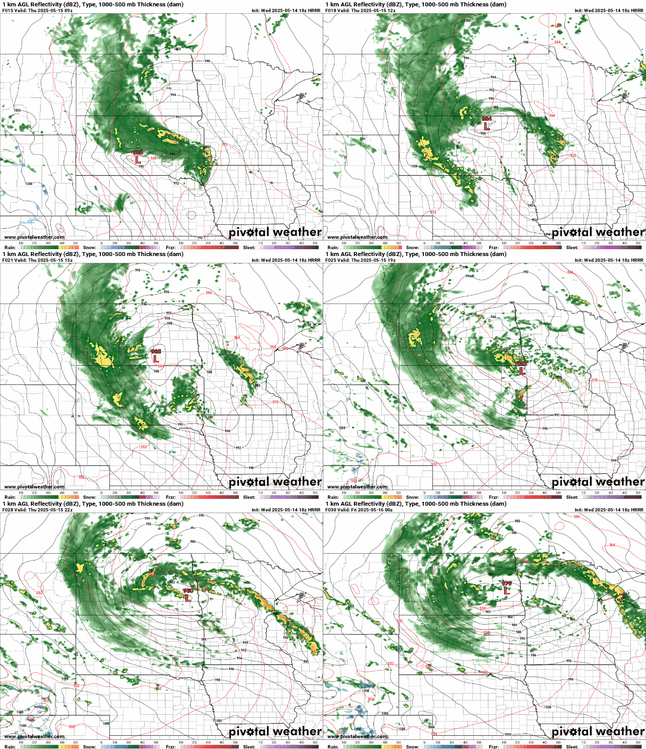
You can read my more detailed post on Thursday’s severe weather risk here. Be alert for possible severe weather watches and warnings Thursday.
Air quality alert extended
Higher humidity and lighter winds are gradually easing fire danger across Minnesota. Some rain may fall in the fire zone Thursday and Friday.

Fires are still burning and smoke will be an issue through at least Thursday afternoon. The Minnesota Pollution Control Agency has extended the air quality alert for northern Minnesota until 4 p.m. Thursday.

Here are the details:
Air quality is expected to reach the orange AQI category in northeast Minnesota, which is unhealthy for sensitive groups.
The Minnesota Pollution Control Agency (MPCA) has extended an air quality alert for northeast Minnesota until 4 p.m. on Thursday, May 15. The affected area includes International Falls, Hibbing, Ely, and the Tribal Nations of Leech Lake and Red Lake.
The Camp House and Jenkins Creek fires in the Superior National Forest of northeast Minnesota remain active and will continue to produce heavy ground-level smoke through Thursday. Winds have shifted to southeasterly on Wednesday and will push the smoke plumes northwest. The plumes will impact portions of St. Louis, Itasca, and Koochiching counties through Thursday afternoon. Over the next couple of days, higher humidity and increased cloud cover should inhibit fire growth and intensity. Smoke is not expected to be as heavy as previous days. A strong low pressure system will move into the state on Thursday and bring showers and thunderstorms to northeast Minnesota by Thursday afternoon. This should decrease fire activity and improve air quality.
Fine particle levels are expected to reach the orange air quality index (AQI) category, a level considered unhealthy for sensitive groups, across northeast Minnesota. This area includes International Falls, Hibbing, Ely, and the Tribal Nations of Leech Lake and Red Lake. In the orange area, sensitive groups should limit prolonged or heavy exertion and time spent outdoors.
Turn Up Your Support
MPR News helps you turn down the noise and build shared understanding. Turn up your support for this public resource and keep trusted journalism accessible to all.

