Twin Cities shatters February snow record; more this weekend
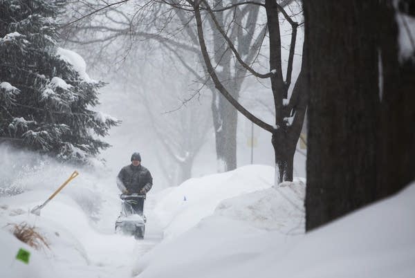
Harry Huie clears snow from the sidewalk in front of his house.
Harry Huie clears snow from the sidewalk in front of his house in Rochester, Minn., Wednesday. The National Weather Service says most parts of the state will see at least 6 inches of snowfall from this storm. Southern Minnesota could get as much as 10.
Christine T. Nguyen | MPR News

Updated: 12:45 p.m. | Posted: 5:50 a.m.

Hat? Check.

Gloves? Check.

Create a More Connected Minnesota

MPR News is your trusted resource for the news you need. With your support, MPR News brings accessible, courageous journalism and authentic conversation to everyone - free of paywalls and barriers. Your gift makes a difference.

Shovel? Check.

Skis? Check.

Good.

Minnesota braced for another heavy snowfall Wednesday as the first of this week's expected storms moved in, roughing up the morning commute, canceling classes and even closing down the runways at the Minneapolis-St. Paul International Airport.

The National Weather Service said that most areas will see at least 6 inches of snow Wednesday, while parts of southern Minnesota, including the Twin Cities, Mankato and Redwood Falls, could see as much as 10 inches.

The heaviest snowfall was expected to fall during the morning commute — snowfall rates could reach an inch per hour at times. It's expected to taper off by afternoon.

The timing of the snowfall led many schools to cancel classes for the day, including Minneapolis, St. Paul and Anoka-Hennepin.

Other schools opted to delay the start of classes by about two hours.

Some businesses decided to shut down as well. Mia announced that it was closing Wednesday due to weather conditions.

Shortly before 9 a.m., the Twin Cities airport closed down its runways due to the fast-falling snow and low visibility. Airport officials reopened one of the runways by about 9:40 a.m.

Looking ahead, two more storms are brewing that could drop fresh coatings of snow on parts of the state Friday and this weekend. The first will hit Friday with several inches possible across central and western Minnesota, the weather service said.

The path of Saturday night's storm is still a little uncertain right now but most models have southern and eastern Minnesota getting at least a few more inches of snow.

The latest storms have pushed the Twin Cities into record territory.

https://twitter.com/NWSTwinCities/status/1098294480850046979