Wettest year, extreme cold: Minnesota's top 5 weather events in 2019

The Twin Cities, Rochester, and St. Cloud all recorded the wettest year on record in 2019.
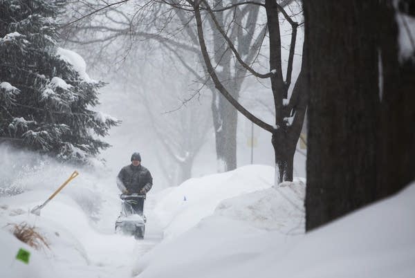
Harry Huie clears snow from the sidewalk in front of his house.
Harry Huie clears snow from the sidewalk in front of his house on Sixth Street in Rochester, Minn., Wednesday, Feb. 20.
Christine T. Nguyen | MPR News 2019

It’s been another record-setting weather year in Minnesota.

January brought the coldest air mass in 26 years. February delivered a record snow blitz and bomb cyclone. July brought extreme heat. And the rain and snow just kept on coming, making 2019 the wettest year on record for several Minnesota locations including the Twin Cities.

Water in cornfield near Stewart, Minnesota
Standing water in a cornfield near Stewart, Minnesota in September 2019
Paul Huttner/MPR News

Here’s a rundown of Minnesota’s major weather highlights in 2019.

Wettest year on record

First the snow blitz. Then relentless rainfall. The wet weather hits just kept on coming in 2019.

Create a More Connected Minnesota

MPR News is your trusted resource for the news you need. With your support, MPR News brings accessible, courageous journalism and authentic conversation to everyone - free of paywalls and barriers. Your gift makes a difference.

2019 was the wettest year on record in the Twin Cities, St. Cloud, and Rochester. Many other locations also recorded annual precipitation at or near record levels.

A record 43.17 inches of precipitation (rain and snow) fell at MSP Airport this year. That’s more than the annual average precipitation for St. Louis, Missouri.

The Twin Cities broke the previous annual precipitation record of 40.32 inches set just in 2016 by nearly 3 inches. Twin Cities precipitation 2019 was an astounding 12.56 inches above average. That extra foot of liquid is roughly an extra 4 months’ worth of rain and snow this year.

Rochester recorded an astounding 55.16 inches of precipitation this year. That’s just about 5 inches shy of the all-time state record of 60.21 inches, set at Harmony in 2018. And 55 inches is about the annual average precipitation for Memphis, Tennessee.

January Arctic outbreak

Minnesota’s January Arctic outbreak was the coldest in 26 years for many Minnesota locations. Cotton, Minnesota plunged to minus 56 on January 28. MSP Airport bottomed out at 28 below zero.

Icicles form on the face of Kyle Johnson after he finished a run.
Icicles form on the face of Kyle Johnson after he finished a run Wednesday, Jan. 30, 2019 at his home in rural Duluth. Johnson decided this was the week to start training for Grandma's Marathon and used wool socks and a wool turtleneck sweater along with a variety of running-specific clothes to stave off conditions that approached 20 below zero during his run.
Derek Montgomery for MPR News

Here’s more perspective on the event from the Minnesota DNR Climate Working Group.

The arctic outbreak from January 27-31, 2019 had some of the lowest air temperatures to visit Minnesota since 1996, and the lowest wind chills since the 1980s.

The bitter cold brought some natural gas shortages just north of the metro and power outages to about 7,000 in the southern and western suburbs. Xcel Energy asked customers statewide to reduce their thermostat setting to 63 degrees. There were also broken water mains, and emergency personnel were busy with frostbite reports. Schools were closed for four days for many in the Twin Cities and outstate. The University of Minnesota was closed on the 30th and postal mail service was stopped statewide.

Air Temperature Recap

The -56 degrees F air temperature at Cotton 3S on January 28, 2019 was the lowest ambient air temperature in Minnesota since the -60 degrees F reading near Tower on February 2, 1996.

The -28 degrees F air temperature in the Twin Cities on January 30, 2019 was the lowest ambient air temperate in the Twin Cities since -32 degrees F on February 2, 1996.

The -13 degrees F maximum temperature in the Twin Cities on January 30, 2019 was the coldest maximum temperate since -17 degrees F on February 2, 1996.

Neither the minimum or maximum temperature in the Twin Cities on January 30 set a record for the date. However, the -56 at Cotton on January 27 did set the daily statewide record minimum temperature for the date. The old record was -54 at Pokegama Dam in 1904. Cotton recorded another -56 F daily low temperature on January 31, breaking the daily statewide record minimum temperature for the date as well. The old record was -55 degrees F at Embarrass in 1996.

Some record cold maximum temperature records were set across the state as the mercury stayed in the teens below zero on January 30. Some of these records include: -14 degrees F at Duluth, -19 degrees F at Rochester and International Falls and -17 degrees F at St. Cloud.

Top 5 weather events of 2019

Each December Minnesota DNR Climate Working Group reaches out to local weather professionals to vote on the top weather events of the year.

Picking the top event can be subjective, but here is this year’s list of the top 5 weather events of 2019, with some honorable mentions including another April blizzard in Minnesota.

Snow ruler
Snow drift in April 2018 blizzard.
Paul Huttner | MPR News

#5 Extreme Heat and Big Storms, July 19, 2019

One day stood out for summer heat in 2019, and it was this one, with heat indices well above 100 degrees. In fact, with an air temperature of 95 F and a dew point temperature of 80 F, the 115 F heat index value at MSP tied for the second highest on record. North of the extreme heat, severe storms produced large hail and wind damage from Otter Tail County eastward through Morrison, Pine and Chisago Counties.

#4 Winter "Bomb" Cyclone, February 22-24, 2019

No memorable winter would be complete without a hallmark storm and this one was one of the largest of the winter. The brunt of the storm missed the Twin Cities, but blizzard conditions quickly developed in the south. Roads became impassible over the southern fifth of the state. Governor Walz declared a State of Emergency in Freeborn and Steele Counties. The National Guard troops were used to rescue stranded motorists and the St. Cloud State men’s hockey team had to find shelter in the Watonwan County Jail.

#3 Record Snows of February 2019

February is not typically known as a snowy month. February 2019 was an exception. The Twin Cities total of 39 inches broke the old record of 26.5 inches by over a foot. There were five calendar days of at least 4 inches of snow. A typical winter usually sees two or three such events. Rochester also set its record of 40.0 inches, St. Cloud had 27.6 inches. This was also the snowiest February on record at 47 of Minnesota's older National Weather Service cooperative observing stations, from all corners of the state.

#2 Another Very Wet Year in Minnesota

2019 was excessively wet across central and southern Minnesota. This caused many issues with high water and high stream and river flows for a good part of the year. Some annual precipitation records fell for major cities, including over 43 inches in the Twin Cities and over 55 inches at Rochester. Despite these high totals, no location threatened the statewide record of 60.21 inches, set at Harmony in 2018.

#1 Cold Outbreak: January 27-31, 2019

This arctic outbreak followed in the wake of a vigorous Alberta Clipper. It was noteworthy for having the coldest air measured in Minnesota since 1996, and the lowest wind chills since the 1980s. Cotton, MN had an air temperature of -56F and the Twin Cities saw -28 F. Many schools were closed for four days in a row, including the University of Minnesota on the 30th. US Postal mail service was stopped statewide. The Minnesota State Climatology Office was open as usual.