Going, going, gone.
Snow cover rapidly vanishing in southwest Minnesota

Go Deeper.
Create an account or log in to save stories.
Like this?
Thanks for liking this story! We have added it to a list of your favorite stories.
It’s beginning to look like spring in parts of southwest Minnesota.
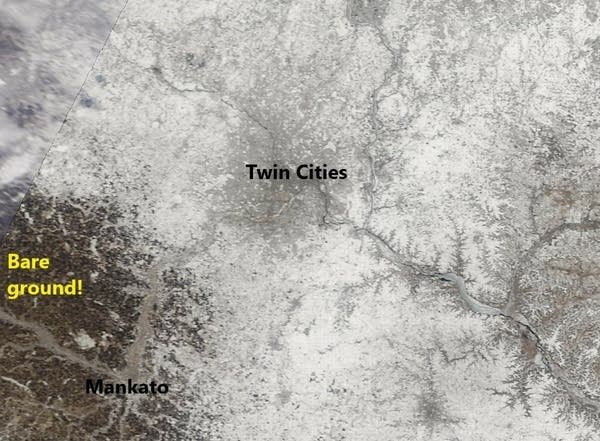
Snow cover vanished rapidly from most of southwest Minnesota this week. In fact, the back edge of snow cover now lies just about 40 miles southwest of the greater Twin Cities area.
Check out this NASA MODIS Terra 250-meter resolution visible image from Wednesday afternoon.

The lack of snow immediately west of the Twin Cities means air masses that blow in have very little cooling effect. Look for temperatures to respond on west on southwest winds.
Deep snow up north
There’s still some deep snow cover in much of northeast Minnesota. Snow depth around or over a foot is common in northeast Minnesota. Here’s the webcam view from Golden Eagle Lodge on the Gunflint Trail. Note the temperature in the 40s on the thermometer.

But it’s common to have 2 feet or more in the deep woods up north this time of year. And what snow is also melting across northern Minnesota.
Temperatures in the next week will further erode snow cover in Minnesota. Get out there and enjoy what snow we have left this season.
Turn Up Your Support
MPR News helps you turn down the noise and build shared understanding. Turn up your support for this public resource and keep trusted journalism accessible to all.


