High winds, heavy snow whack northern, western Minnesota; storm intensifies

Parts of Minnesota are in a blizzard warning as winds could gust over 50 mph.

A vehicle travels along a highway in snowy weather
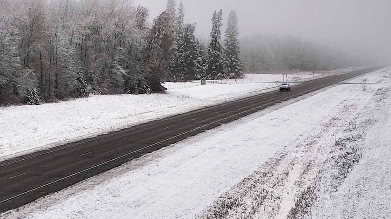
A vehicle travels along State Highway 89 in snowy conditions on Thursday near Red Lake, Minn., as an early-winter storm affects the region.
Minnesota Department of Transportation

Updated 9:20 a.m.

Half of Minnesota is under various watches, warnings and advisories due to weather concerns, and the entire state can expect snow and gusty winds as the storm intensifies and colder air filters across the state.

Storm impacts through Friday

weather graphic
Forecast storm position late Thursday
National Weather Service

The strong storm that moved rain across Minnesota beginning Wednesday (with a little snow north), now has its low pressure center in northern Wisconsin as of Thursday morning, with a little rain lingering along eastern Minnesota, especially in the Arrowhead.

However, instead of continuing east as many storms do, taking the precipitation with it, this storm is moving north and will track over Minnesota’s Arrowhead/Lake Superior area where it intensifies during the day Thursday.

The falling pressure of the storm is already making winds gusty. They will increase late Thursday into Friday, with most of the state seeing gusts over 30 mph and western Minnesota likely to see gusts top 50 mph.

Political Coverage Powered by You

Your gift today creates a more connected Minnesota. MPR News is your trusted resource for election coverage, reporting and breaking news. With your support, MPR News brings accessible, courageous journalism and authentic conversation to everyone - free of paywalls and barriers. Your gift makes a difference.

weather graphic
Forecast peak wind gusts through Friday.
National Weather Service

Minnesota is now on the cold side of the storm, although Thursday morning temperatures are mild for November, in the 30s, with a couple 40s south. However, those temperatures barely budge during the day, and many spots have already hit their highs for Thursday and will even fall a couple of degrees by the afternoon.

weather graphic
Thursday afternoon temperatures.
National Weather Service

This keeps northern Minnesota cold enough that more of the precipitation Thursday turns to snow, while other areas see spotty rain during the day.

As temperatures start cooling more Thursday evening and overnight, more of the precipitation will turn to snow. Friday stays even chillier, with highs only in the 30s for the entire state.

weather graphic
Watches, warnings and advisories through Friday.
National Weather Service

With how the moisture will wrap around the intensifying storm, northern Minnesota can expect heavy snow to begin by Thursday afternoon, prompting a winter storm warning starting at noon (in pink).

For western Minnesota, the snow will be less, but the high winds have a couple of counties in a blizzard warning (in red) beginning at 9 p.m.

Other watches and advisories that come into effect Thursday afternoon (north) through the evening (south), include winter storm warnings (blue), winter weather advisories (purple) and wind advisories (beige).

In other words, this first winter storm of the season is packing a big punch, although the eastern edge of the state, including the Twin Cities, misses the worst of it. 

Here are the forecast snow totals through Friday:

weather graphic
Forecast snowfall through Friday.
National Weather Service

The different watches, warnings, and advisories are currently all set to expire at times ranging between 6 a.m. and noon Friday as conditions slowly improve. Winds slowly lessen through the day Friday, although they will still be gusty all day.

Snow slowly winds down during the day (and for southern some rain mixes back in during the day), before ending by Friday evening.

More snow possible

Although our multiday storm finally wraps up by late Friday, the chances for snow do not end.  Already Saturday, another disturbance brings a renewed likelihood of snow across the state.

That system moves quickly west to east from Saturday morning through Sunday morning, with most of the state forecast to see less than 2 inches of snow. Winds also stay relatively light, so blowing snow is not expected to be a concern.

For the Twin Cities, it currently looks like totals should be from about one-half to 1 inch of snow.

weather graphic
Twin Cities temperature trend through Tuesday
National Weather Service

That disturbance reinforces colder air behind the major storm, so highs throughout Minnesota stay only in the 30s through Monday, with a few 20s north.

By Monday, a bit more sunshine returns to the forecast, and most of the state rebounds into the 40s or low 50s by Tuesday.

Here is that temperature forecast for the Twin Cities:

Programming note

You can hear my live weather updates on Minnesota Public Radio at 7:49 a.m. Monday through Friday morning.