Eighth snowiest snow season in the Twin Cities; How much will we add to it today?

Highest Sunday snow totals in northeastern Minnesota and northern Wisconsin
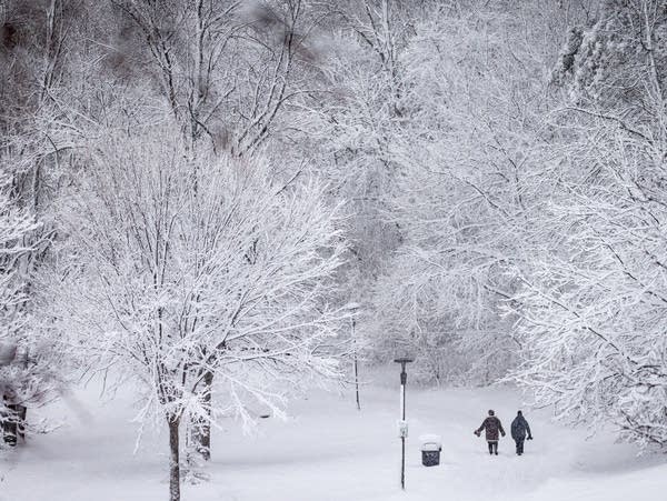
Two people walk among snowy trees
Two people walk through Powderhorn Park in Minneapolis on Wednesday, Jan. 4, 2023.
Ben Hovland | MPR News

The Saturday snow tally at Minneapolis-St. Paul International Airport was 2.0 inches, which raised the official 2022-2023 snow season total to 80.0 inches in the Twin Cities.

This is now the eighth snowiest snow season in Twin Cities weather records:

Another 1.4 inches of snow will lift this snow season into seventh place:

rt0312seasonsno2
Twin Cities highest season snowfall totals (with update)
Minnesota State Climatology Office

The average Twin Cities season snowfall total is 51.2 inches.

Create a More Connected Minnesota

MPR News is your trusted resource for the news you need. With your support, MPR News brings accessible, courageous journalism and authentic conversation to everyone - free of paywalls and barriers. Your gift makes a difference.

Prior to the current season, the last impressive snow season in the Twin Cities was four years ago, with 77.1 inches of snow:

rt0312snowmonth2
Twin Cities monthly and season snow totals
Minnesota State Climatology Office

Additional snow

A low pressure system will spin additional snow over much of Minnesota and Wisconsin today and into Sunday night.

The National Oceanic and Atmospheric Administration’s North American Mesoscale (NAM) forecast model shows the potential precipitation pattern from noon today to 7 a.m. Monday:

rt0312rad9
Simulated radar from noon Sunday to 7 a.m. Monday
NOAA, via Tropicaltidbits.com

How much snow today and tonight?

Snow amounts today and tonight will be highest in portions of northeastern Minnesota and into northern Wisconsin:

rt0312dlh
Additional snowfall Sunday through Monday morning
National Weather Service

Additional Sunday snow totals in the Twin Cities metro area are expected to be generally less than one inch, with higher amounts to the northeast and east:

rt0312mpxsno
Additional snowfall Sunday and Sunday night
National Weather Service

Minnesota road conditions can be found here. Wisconsin road conditions can be found here.

You can find updated weather information for Minnesota and western Wisconsin on the Minnesota Public Radio News network, and on the MPR News live weather blog.

Warnings and advisories

Winter storm warnings continue Sunday in north central and northeastern Minnesota and northwestern Wisconsin:

 rt0312dlhadv
Warnings and advisories Sunday and Sunday evening
National Weather Service

Here are warning details in north central Minnesota and parts of northeastern Minnesota:

URGENT - WINTER WEATHER MESSAGE National Weather Service Duluth MN 405 AM CDT Sun Mar 12 2023 MNZ010-011-018-019-026-122115- /O.CON.KDLH.WS.W.0008.000000T0000Z-230313T0000Z/ Koochiching-North St. Louis-North Itasca-Central St. Louis- South Itasca- Including the cities of International Falls, Ely, Bigfork, Hibbing, and Grand Rapids 405 AM CDT Sun Mar 12 2023 ...WINTER STORM WARNING REMAINS IN EFFECT UNTIL 7 PM CDT THIS EVENING... * WHAT...Heavy snow. Additional snow accumulations of 2 to 4 inches. * WHERE...Koochiching, North St. Louis, North Itasca, Central St. Louis and South Itasca Counties. This includes the Tribal Lands of the Bois Forte Band, Lake Vermilion, Nett Lake and, Deer Creek areas. * WHEN...Until 7 PM CDT this evening. * IMPACTS...Plan on slippery road conditions. PRECAUTIONARY/PREPAREDNESS ACTIONS... If you must travel, keep an extra flashlight, food, and water in your vehicle in case of an emergency. The latest road conditions can be obtained by calling 5 1 1. Road conditions can also be found at 511mn.org for Minnesota or 511wi.gov for Wisconsin.

Here are winter storm warning details for Duluth and up along the North Shore to Silver Bay:

URGENT - WINTER WEATHER MESSAGE National Weather Service Duluth MN 405 AM CDT Sun Mar 12 2023 MNZ020-037-122115- /O.CON.KDLH.WS.W.0008.000000T0000Z-230313T0600Z/ Southern Lake-Carlton and South St. Louis- Including the cities of Two Harbors, Silver Bay, and Duluth 405 AM CDT Sun Mar 12 2023 ...WINTER STORM WARNING REMAINS IN EFFECT UNTIL 1 AM CDT MONDAY... * WHAT...Heavy snow. Additional snow accumulations of 4 to 6 inches. Winds gusting as high as 35 mph, causing blowing and drifting snow. * WHERE...Southern Lake and Carlton and South St. Louis Counties. This includes the Tribal Lands of the Fond du Lac Band. * WHEN...Until 1 AM CDT Monday. * IMPACTS...Travel could be very difficult. PRECAUTIONARY/PREPAREDNESS ACTIONS... If you must travel, keep an extra flashlight, food, and water in your vehicle in case of an emergency. The latest road conditions can be obtained by calling 5 1 1. Road conditions can also be found at 511mn.org for Minnesota or 511wi.gov for Wisconsin.

Here are details of the winter storm warning from Pine County of Minnesota into northwestern Wisconsin:

URGENT - WINTER WEATHER MESSAGE National Weather Service Duluth MN 405 AM CDT Sun Mar 12 2023 MNZ038-WIZ001-006-007-122115- /O.CON.KDLH.WS.W.0008.000000T0000Z-230313T0600Z/ Pine-Douglas-Burnett-Washburn- Including the cities of Pine City, Hinckley, Superior, Grantsburg, and Spooner 405 AM CDT Sun Mar 12 2023 ...WINTER STORM WARNING REMAINS IN EFFECT UNTIL 1 AM CDT MONDAY... * WHAT...Heavy snow and light freezing drizzle. Additional snow accumulations of 3 to 5 inches and ice accumulations of a light glaze. Winds gusting as high as 35 mph causing blowing and drifting snow. * WHERE...In Minnesota, Pine County. In Wisconsin, Douglas, Burnett and Washburn Counties. This includes the Tribal Lands of the Mille Lacs Band, Lena Lake and, Hinckley areas. * WHEN...Until 1 AM CDT Monday. * IMPACTS...Travel could be very difficult. * ADDITIONAL DETAILS...Snow will mix freezing drizzle until 8 AM. After 8 AM, precipitation will be all snow.

A winter weather advisory continues until 1 a.m. Monday from Rice Lake, Wisconsin to Eau Claire:

URGENT - WINTER WEATHER MESSAGE National Weather Service Twin Cities/Chanhassen MN 1038 AM CDT Sun Mar 12 2023 WIZ015-025-027-028-130100- /O.CON.KMPX.WW.Y.0015.000000T0000Z-230313T0600Z/ Barron-Dunn-Chippewa-Eau Claire- Including the cities of Rice Lake, Menomonie, Chippewa Falls, and Eau Claire 1038 AM CDT Sun Mar 12 2023 ...WINTER WEATHER ADVISORY REMAINS IN EFFECT UNTIL 1 AM CDT MONDAY... * WHAT...Snow. Additional snow accumulations of 1 to 3 inches. Winds gusting as high as 35 mph. * WHERE...Barron, Dunn, Chippewa and Eau Claire Counties. * WHEN...Until 1 AM CDT Monday. * IMPACTS...Plan on slippery road conditions. PRECAUTIONARY/PREPAREDNESS ACTIONS... Slow down and use caution while traveling. The latest road conditions for the state you are calling from can be obtained by calling 5 1 1. Road conditions can also be found at 511mn.org for Minnesota or 511wi.gov for Wisconsin.

Check forecast updates if you have Sunday or Sunday night travel plans in north-central or northeastern Minnesota or in Wisconsin.

The coming week

Some areas of eastern Minnesota will see a few leftover snow showers Monday morning, then Tuesday and Wednesday look mostly dry.

Some forecast models show the potential for rain in eastern Minnesota on Thursday, with snow or a mix in the west. There is the potential for a rain/snow mix Thursday night, with the possibility of snow in most areas on Friday.

Check back for details as we get closer to Thursday.

Much of Minnesota will have Sunday highs in the 30s, with a few upper 20s in far western and far northern Minnesota.

Monday highs will be mainly in the 20s:

rt0313h10
Monday forecast highs
National Weather Service

A few spots in the Twin Cities metro area could touch 30 on Monday. That’s still cool, compared to the average March 13 high temp of 40 in the Twin Cities.

Twin Cities metro area highs are projected to reach the lower 30s on Tuesday, followed by lower 40s Wednesday and Thursday. Metro area highs could retreat to the lower 30s on Friday.

Weather nugget

Twin Cities sunset is at 7:15 p.m. today.

One month from today, Twin Cities sunset is at 7:54 p.m., and sunset is at 8:31 p.m. on May 12.

Programming note

You can hear my live weather updates on MPR News at 7:35 a.m., 9:35 a.m. and 4:39 p.m. Saturday and Sunday.