Minnesota first responders and emergency management experts are returning home in waves after lending their time to the community of Greenfield, Iowa, where an EF4 tornado killed four people, injured dozens more and wrecked more than 200 homes.
A line of storms with the potential for damaging winds greater than 60 mph and hail larger than 1 inch in diameter will sweep through from west to east Tuesday afternoon and evening and most likely move through the Twin Cities region between 5 p.m. and 8 p.m.
Get ready for another round of thunderstorms with heavy rainfall potential Tuesday afternoon and evening. It will be followed by drier and cooler air along with wind Wednesday.
After a very wet Sunday night we’ll see decreasing clouds Monday. Isolated afternoon thunder is again possible, but more organized storms develop Tuesday.
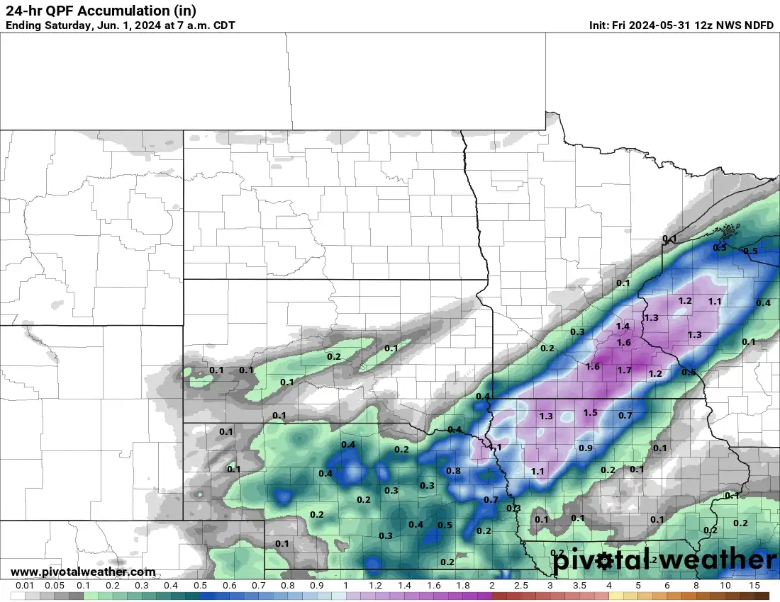
We’ll have scattered showers and thunder Friday with heavy rainfall potential for southern Minnesota. More storms are possible Sunday and some could be strong.
When it comes to staying informed in Minnesota, our newsletters overdeliver. Sign-up now for headlines, breaking news, hometown stories, weather and much more. Delivered weekday mornings.