It’s a cooler day Tuesday behind Monday’s cold front with highs mainly in the 70s. We have a few minor rain chances ahead and the possibility of auroras in northern Minnesota.
Cooler and much drier air has settled in behind a cold front for Tuesday and Wednesday. Highs will be mainly in the 70s. We’ll see a few relatively minor rain chances ahead.
Parts of Arizona, Texas and South Florida are forecast to see dangerous temperatures again after a weekend of extreme heat. Forecasters warn against spending time outdoors.
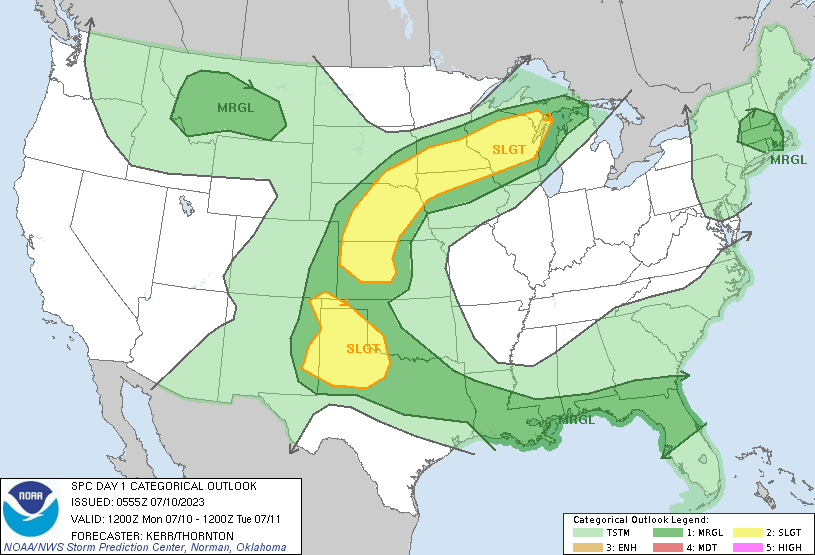
There’s plenty of heat and enough moisture in the atmosphere for scattered storms Monday afternoon and evening. That includes a slight risk for severe storms from the Twin Cities area to the south and east through the evening.
A cold front will push hot weather ahead of it Monday with highs in the low 90s south. That front will touch off potential severe storms late Monday with cooler air behind it Tuesday.
A cold front will divide the state Monday. High temperatures will range from the low 90s south to near 70 north with storms developing south in the evening ahead of the cold front.
When it comes to staying informed in Minnesota, our newsletters overdeliver. Sign-up now for headlines, breaking news, hometown stories, weather and much more. Delivered weekday mornings.