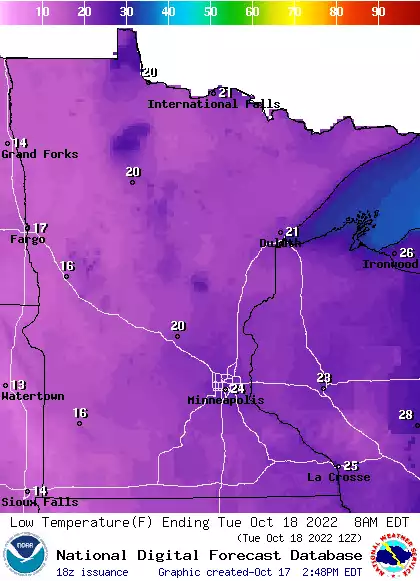
Tuesday will remain chilly with highs in the 30s to low 40s but with sunshine and slightly lighter winds. We’re still on track to see 60s and 70s in southern Minnesota this weekend.
It’ll be another unseasonably cold day Tuesday with highs in the 30s to low 40s in southern Minnesota. We should see mostly sunny skies. Wind chills are starting out in the teens and even single digits. Temperatures trend upward Wednesday into the weekend.
Climate change-fueled hurricanes and sea-level rise get a lot of attention, but Mississippi River Basin communities also are experiencing the effects of global warming.
Unusually frigid air will grip Minnesota Monday and Tuesday with highs only in the 30s to low 40s. Wind chills will be in the 20s and teens. Temperatures warm dramatically by the end of the week.
Temperatures will be unseasonably chilly Monday and Tuesday with highs just in the 30s Monday. Winds will blow from the north at 10-20 mph with gusts of 20-30 mph pushing wind chills into the 20s and teens. Monday night will bring frigid lows in the teens north and 20s south. A big warmup develops late week.
It’ll feel like November on Monday and Tuesday, then temps warm up nicely by the end of the week. We have info on all that, plus a look at the heavy snow that will hit parts of north-central Wisconsin and northern Michigan. We also have the latest fall color report.
Chilly temps will stay with us through Tuesday, then temps will recover nicely. We have an updated Sunday forecast and fall color map, plus a look at the week ahead.
A warm coat will feel good today, with chilly temps and gusty winds in the forecast. Some occasional rain and snow showers are expected in parts of northern Minnesota and western Wisconsin.
When it comes to staying informed in Minnesota, our newsletters overdeliver. Sign-up now for headlines, breaking news, hometown stories, weather and much more. Delivered weekday mornings.