The first half of this week will be cool and below normal with frost possible in many areas Monday and Tuesday nights. A warmup develops later this week into the weekend with 70s returning for southern Minnesota.
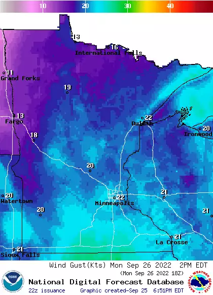
Monday will be a cool, windy day with highs ranging from just 50 in northeast Minnesota to the mid 60s southwest. We’ll see a mix of clouds and sun with frost possible for parts of Minnesota Monday and Tuesday nights.
Forecasters say Tropical Storm Ian has strengthened into a hurricane as it moves closer to Cuba on a track expected to hit Florida in the coming days. Authorities in Cuba are planning evacuations.
Our winds will back off a bit on Monday, but it’ll still be breezy. We take a look at the week ahead, which includes a couple of mornings with frost potential. We also have the latest on Tropical Storm Ian, which is expected to become a major hurricane this week.
We’ll have strong winds Sunday afternoon, but plenty of sunshine in most areas. We have details on that, plus a look at the week ahead, including some very chilly morning temps. We also have an update on Tropical Storm Ian, which is expected to become a major hurricane this week.
This will be a bad hair day for many of us, due to strong winds. We have details on the winds, plus a look at high temps and who could see some rain today.
More than 500,000 customers in Nova Scotia and other Atlantic provinces lost power as the large post-tropical cyclone made landfall and damaged homes with strong winds and rain.
When it comes to staying informed in Minnesota, our newsletters overdeliver. Sign-up now for headlines, breaking news, hometown stories, weather and much more. Delivered weekday mornings.