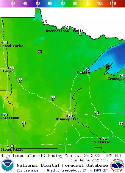
Temperatures will remain cooler than normal slightly for much of Minnesota this week. Scattered showers and some thunder develop Tuesday. Heat is building in for the weekend and first days of August.
The cooler temperatures and lower dew points will dominate through Friday. The next chance of showers and thunderstorms spreads across northern and central Minnesota Tuesday though amounts will be light in drought stricken areas.
Many places in the Northeast are likely to see record-breaking temperatures on Sunday, and while relief may be on the way, temperatures are expected to heat up in places like the Pacific Northwest.
Comfortable temps and dew points will stay with us today and Monday. We take a look at the week ahead, including our next chance of rain. The Saturday rainfall map shows who had the soaking rains this weekend.
Saturday rain totals varied widely across the Twin Cities metro area. We take a look at those rain totals and the outlook for Sunday and the week ahead.
A severe thunderstorm watch continues until 7 p.m. this Saturday in southeastern Minnesota and portions of west-central and southwestern Wisconsin. We have the severe weather update.
A severe thunderstorm watch includes the Twin Cities and much of southern Minnesota and parts of central Minnesota until 2 p.m. today. Be sky-aware today and have a way to receive warnings. A severe thunderstorm watch also includes southeastern Minnesota until 7 p.m.
When it comes to staying informed in Minnesota, our newsletters overdeliver. Sign-up now for headlines, breaking news, hometown stories, weather and much more. Delivered weekday mornings.