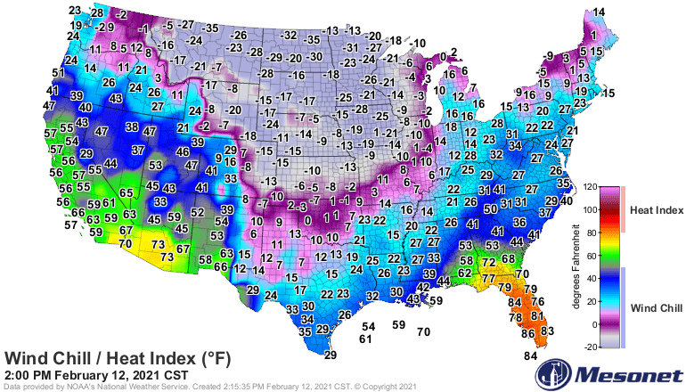
In the wake of Wednesday’s crippling snowstorm, arctic air has spread across Minnesota. Combined with lingering winds, wind chills stay brutally cold through the day.
Blowing snow will continue to re-cover roadways that may have been cleared by plows. Travel conditions will remain dangerous across Minnesota into early Thursday. Meanwhile, a wind chill advisory is in effect for most of Minnesota through the morning.
A major winter storm brought strong winds and heavy snow Wednesday. Here are some photos from around the Twin Cities, which was included in the blizzard warnings.
Blizzard warnings are in effect from much of western, central, and southern Minnesota. The greater Twin Cities area is included in the blizzard warning zone.
Almost half of Minnesota is under a blizzard warning, with the rest of the state under warnings and advisories. The Twin Cities is in line for about 6 to 10 inches of snow, while portions of northeastern Minnesota could see even more.
Forecast models are cranking out increasing snowfall totals for the Twin Cities. Morning rain will rapidly change to snow during the midday hours Wednesday. Get to where you need to be by noon and plan to hunker down.
Increasing southerly breezes Tuesday will push our Minnesota temperatures well above normal for late December. A strengthening winter storm will bring snow to Minnesota Tuesday night and Wednesday. Christmas Day weather looks to be uneventful.
Mild temperatures courtesy of increasing southerly winds are on tap for Tuesday. A strengthening winter storm will bring snow from west to east Tuesday night and Wednesday. Strong northwest winds on the back side of the cold front will cause blowing and drifting snow along with plummeting temperatures on Wednesday.
When it comes to staying informed in Minnesota, our newsletters overdeliver. Sign-up now for headlines, breaking news, hometown stories, weather and much more. Delivered weekday mornings.