According to retired University of Minnesota meteorologist and climatologist Mark Seeley, a prolonged dry spell and frequent freezing temperatures at night have helped keep many rivers at manageable levels.
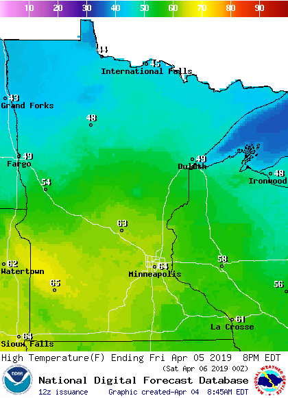
On Saturday, the southern third of Minnesota should top 60, with 50s in central Minnesota and 40s far north. Twin Cities metro area highs are projected to reach the upper 60s Monday, followed by upper 50s Tuesday, 50 Wednesday and mid 40s Thursday.
Most of Minnesota will see highs in the 40s Thursday afternoon, with some 30s up along the North Shore of Lake Superior. A few spots in central Minnesota could touch 50 degrees, while the metro area probably peaks in the upper 40s.
The south-central Minnesota town of Henderson is throwing its first-ever Flood Fest to embrace the flood that's closed off crucial roads, and to call attention to the need for flood mitigation. Meanwhile, in the Red River Valley, all eyes are on the gauges.
April showers return to the weather picture across southern Minnesota Thursday and this weekend. Spotty light showers across southern Minnesota Thursday. Scattered showers Saturday, with more widespread rain Sunday.
Dry weather and a slow snow melt has lowered the flood risk for the cities along the Red River. But just beyond them, across the countryside, farmers and rural residents are still preparing for flooding that might isolate them for days.
When it comes to staying informed in Minnesota, our newsletters overdeliver. Sign-up now for headlines, breaking news, hometown stories, weather and much more. Delivered weekday mornings.