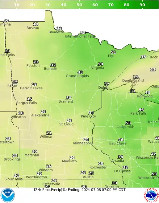
We’ll continue to have isolated to spotty, pop-up showers and thunder both Monday and Tuesday afternoons. The rest of the week is mostly dry and becoming warmer.
The heat wave in the U.S. is far from over. Parts of both coasts are bearing the brunt of the heat with record-breaking temperatures. The heat will continue its grip over the next few days.
Rapidan Dam’s partial failure sent an estimated 11.6 million cubic yards of sediment downstream. Experts are worried about its ecological impacts and say it could take years to fully understand them.
The next few days won’t be a washout but there will be spotty showers and thunder Friday and Saturday mostly. Next week looks drier and warmer overall.
For decades, public housing providers could subsidize heating bills but not air-conditioning. New Biden administration guidance changes that, but critics say it doesn’t go far enough.
Record-shattering ocean temperatures have helped Beryl gain strength as it moves through the Caribbean. It is the most powerful Atlantic hurricane ever recorded this early in the year.
Showers and thunderstorms develop Thursday. A few could be strong and locally heavy rainfall is possible. Spotty storm chances persist into the weekend.
When it comes to staying informed in Minnesota, our newsletters overdeliver. Sign-up now for headlines, breaking news, hometown stories, weather and much more. Delivered weekday mornings.