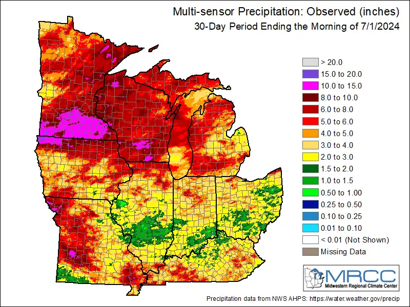
After the wettest April-June period on record, you would hope we’d catch a break with some sunny dry weather for the Fourth of July holiday. But another wave of rain and thunderstorms looks likely for much of Minnesota Thursday.
With climate warming, when it rains it really pours. MPR News host Angela Davis talks with the Minnesota commerce commissioner and the state climate director about why we’re seeing an increase in intense rain and violent storms and how we can prepare for and prevent damage from floods, wind and hail.
Lingering showers will track east Tuesday morning. More thundershowers are possible late Tuesday. Wednesday looks dry and sunny but more storms develop Thursday that could dampen the Fourth of July holiday.
Minnesota has about $24 million in the bank to pay for disasters like the recent floods, but the federal government is expected to pay for most of the damage.
Beryl strengthened from a tropical storm into a hurricane on Saturday as the storm made its way through the southeast Caribbean. Forecasters expect it to intensify rapidly into a major hurricane.
When it comes to staying informed in Minnesota, our newsletters overdeliver. Sign-up now for headlines, breaking news, hometown stories, weather and much more. Delivered weekday mornings.