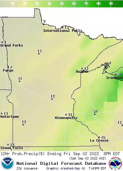
Overnight rainfall left some areas saturated and others parched. Skies will clear Friday and it will be very warm and humid. An isolated thunderstorm is possible Saturday then 90s build in Sunday.
Morning showers and thunder move east and skies will clear into the afternoon Friday. It will be humid with temperatures in the 80s south and 70s north.
Temperatures will be warmer Thursday and humid air will start to return to southwestern Minnesota and spread east overnight into Friday, touching off scattered thunderstorms.
We’ll have a fair amount of sunshine but warmer temperatures and higher dew points return. We’ll also have the chance of some overnight showers and thunderstorms Thursday night.
It’s been a hot and steamy week with some surprising pop-up storms. Let’s get the details and the forecast with MPR’s chief meteorologist Paul Huttner.
When it comes to staying informed in Minnesota, our newsletters overdeliver. Sign-up now for headlines, breaking news, hometown stories, weather and much more. Delivered weekday mornings.