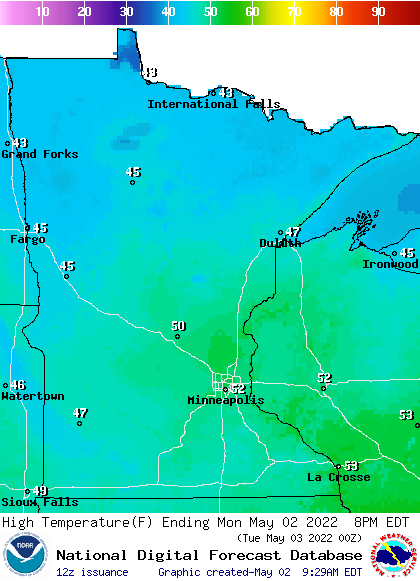
We had gorgeous March weather on Sunday, but snow is in the forecast for some areas Sunday night and Monday morning. We have the forecast details, including the warmth that’s expected by midweek.
We’ll have pleasant March weather today, with much milder temps than yesterday. Some areas will see snow Sunday night into early Monday. We have details on all that, plus the warm temps that are in the forecast this week.
Warmer temps are on tap for Sunday, and much of the coming week will be warmer than normal. We have your forecast details, including who may see some snow.
Our chilly Saturday temps will be replaced with much milder highs on Sunday. Some spots in the north will see some snow Saturday afternoon and evening. We have details on that, plus some very warm temps in the week ahead.
This may be our last sub-zero low temp of the winter. Chilly highs are on tap for most of us Saturday afternoon, and northern Minnesota will see some snow later today.
We’ll start our weekend with cold and wind chills, but temperatures recover nicely on Sunday. The best weekend snow chances will be in northern Minnesota. We have your weekend forecast, plus the updated Minnesota snow cover map.
Wind chills will be frigid through the day Friday as high temperatures won’t get past the low to mid teens in southern Minnesota and barely reach zero in some places up north. Temps drop to subzero statewide overnight into Saturday. A rapid warm up starts Sunday.
It’s another chilly morning early Friday, but the return of the wind is what’s making it really feel cooler. Winds are near 20 mph for much of Minnesota, creating wind chills that are subzero nearly statewide. In fact, northwest Minnesota has wind chills near 30 below zero.
When it comes to staying informed in Minnesota, our newsletters overdeliver. Sign-up now for headlines, breaking news, hometown stories, weather and much more. Delivered weekday mornings.