Temperatures are just below freezing early Wednesday morning. There are scattered light snow showers, mixed with some light freezing rain so watch out for some potential brief slick spots on untreated surfaces. We’ll see highs today above freezing again for the southern half of Minnesota, 20s north.
Our first day of March felt a little like spring. We hit 41 degrees in the Twin Cities Tuesday afternoon. That’s the first back-to-back 40 degree days in the Twin Cities since mid-December.
A March storm will bring a mixed bag of precipitation types from late Friday night into Sunday. The locations of the heaviest snow bands are still uncertain, but there are some distinct trends as of Tuesday.
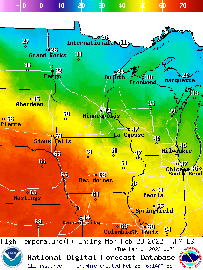
Expect high temperatures Tuesday in the 30s to near 40 in southern Minnesota and 20s in the north. Overnight into Wednesday we’ll see a possible wintry mix of precipitation sweep across central Minnesota.
It’s a mild start early Tuesday with temperatures in the 20s and low 30s in the southern parts of Minnesota. It’s much colder along the international border, near zero in International Falls. We’ll see highs back above freezing in the south and 20s to the north. There’ll be a few light snow showers in west central Minnesota Tuesday.
A mild Monday is on the way with highs in the low 40s in the Twin Cities and even 50s for portions of southwestern Minnesota. Northeastern Minnesota will be in the 20s as light snow showers move through. A Friday night snowstorm is possible but it’s still too soon to forecast.
You’ll already notice the milder start to our mornings this week compared to last. Monday morning temperatures are mainly in the teens north and even low 20s south. Highs Monday will be in the low 40s in southern Minnesota to mid-20s in the far north. Northeastern Minnesota will also see light snow Monday.
When it comes to staying informed in Minnesota, our newsletters overdeliver. Sign-up now for headlines, breaking news, hometown stories, weather and much more. Delivered weekday mornings.