We’ll have enjoyable weather this Sunday, and Monday will be the warmest day of the coming week. We have the forecast details, including snow potential in northern Minnesota on Monday.
These mild temps will stay with us well into next week. We take a look at temperature trends over the next few days and the potential for snow in some areas. Also, we chart the typical spring warmup.
Our weekend temps will be fairly typical for late February. Saturday will be a bit breezy, then winds back off a bit on Sunday. We have your forecast details for the week ahead, plus a look at March snowfall over the past few years.
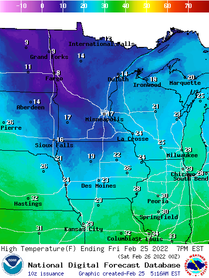
Another cold morning leads to another chilly day Friday. Highs Saturday will be in the 30s in southern Minnesota, with 20s north. Sunday will be a little cooler. Expect temps well into the 30s next week with a couple of days at 40 degrees or higher in the southern half of Minnesota.
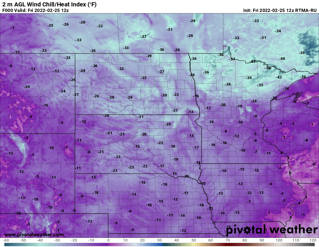
After a fresh 1 to 2 inches of snow Thursday, it’s a chilly morning again Friday. Temperatures remain above zero from the Twin Cities south and east but most of Minnesota is below zero again with 30s below zero again in northeast Minnesota. Highs will once again remain cold, in the teens mainly.
Our Thursday evening snow will be followed by chilly Friday temps. Much milder weather is on tap for the weekend. We also have the updated spring flooding outlooks.
Metro area snow totals of 1 to 2 inches are possible, and parts of southeastern Minnesota could see around 3 inches before it tapers off Thursday evening. Expect 20s and 30s over the weekend across Minnesota, with Saturday being the milder day.
When it comes to staying informed in Minnesota, our newsletters overdeliver. Sign-up now for headlines, breaking news, hometown stories, weather and much more. Delivered weekday mornings.