Freezing rain, snow return Monday as powerful winter storm lingers

Winter weather advisory in effect for central, southeastern Minnesota until midnight

Mankato snowstorm4
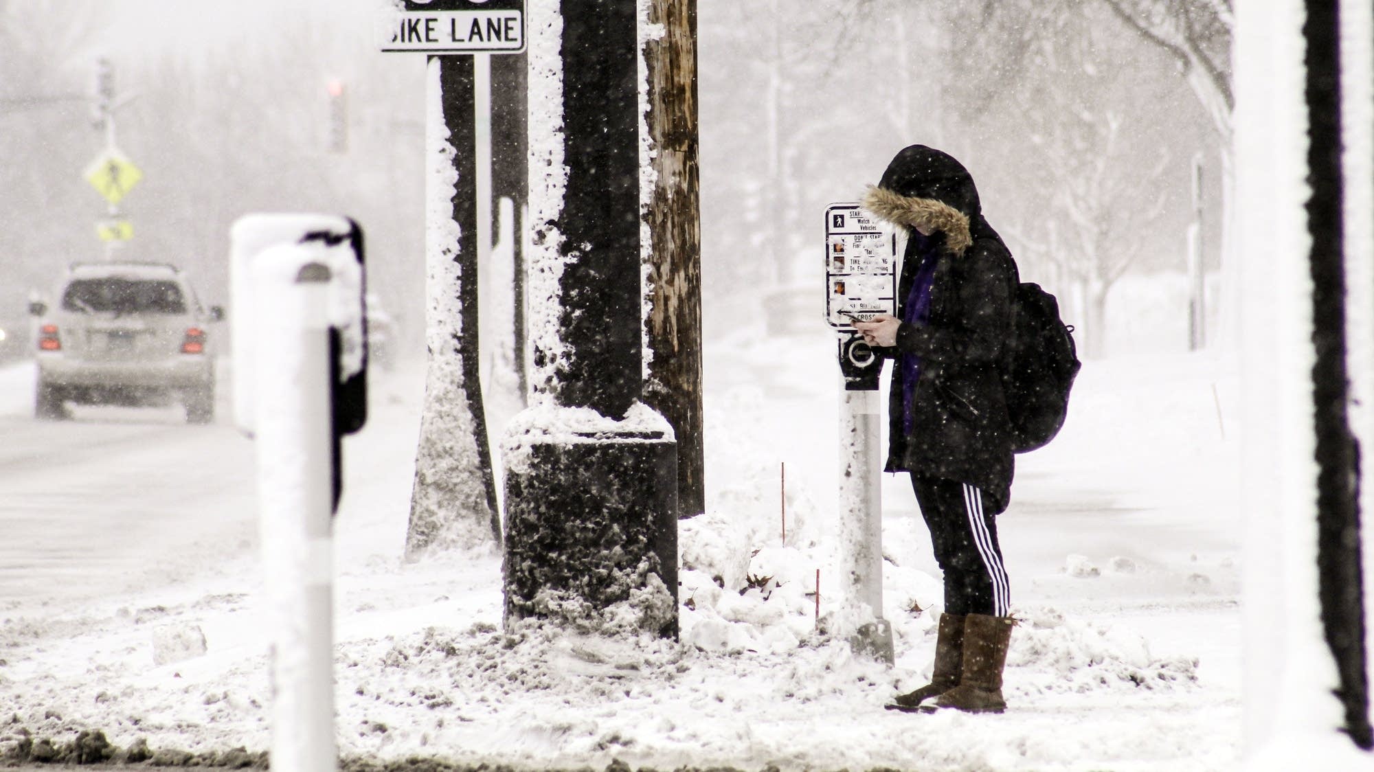
A Minnesota State University, Mankato student waits to cross the crosswalk during a snowstorm Monday. MnDOT officials anticipate more inclement weather to continue going into Tuesday.
Hannah Yang | MPR News

Updated: 8:05 p.m.

It's going to be another messy day across Minnesota.

The winter storm that blasted the state over the weekend continues as snow returns and temperatures fall Monday. A winter weather advisory is in effect until midnight for portions of central and southeastern Minnesota, where periods of heavy snow and gusty winds are expected to create difficult travel conditions. An advisory has also been posted until 6 p.m. for portions of eastern North Dakota.

Snow began falling early Monday in the Twin Cities. Up north, a wintry mix of drizzle, freezing drizzle and snow will change to all snow by afternoon, with on and off periods of heavy snow through evening. Falling temperatures will lead to refreeze by late afternoon.

Both Minneapolis and St. Paul declared a snow emergency for Monday night. Minneapolis parking rules and St. Paul rules can be found on municipal websites.

Create a More Connected Minnesota

MPR News is your trusted resource for the news you need. With your support, MPR News brings accessible, courageous journalism and authentic conversation to everyone - free of paywalls and barriers. Your gift makes a difference.

By the time it's all over, the Duluth area is expected to get an additional 2 to 5 inches of snow, while St. Cloud will see 2 to 3. The Twin Cities and Rochester area could see anywhere from 4 to 6 inches.

Forecasters expect 10 to 14 inches of snow along Lake Superior's south shore. Wind gusts topping 60 mph whipped up waves that crashed over shoreline barriers in Duluth and Grand Marais, Minn., causing localized flooding Sunday.

The snow should begin to taper off Monday night, ending by Tuesday morning, the National Weather Service said.

The Fargo-Moorhead region is forecasted to see some light snow, with accumulations of about an inch of new snowfall.

Over the weekend, icy roads and whiteout conditions made travel treacherous across Minnesota and parts of the Dakotas.

As of Sunday night a no-travel advisory continued for parts of northwest Minnesota from Pelican Rapids and Detroit Lakes west to Moorhead and north to East Grand Forks. That included Interstate 94 from Moorhead to near Barnesville, U.S. Highway 10 from Moorhead to Hawley, U.S. Highway 75 between Moorhead and Crookston and U.S. Highway 2 between East Grand Forks and Erskine.

Greg Gust, National Weather Service meteorologist in Grand Forks, N.D., said the heaviest band of snow fell from Watertown, South Dakota through the Red River Valley corridor in eastern North Dakota, where amounts of 18 inches were common. Gust said the highest total so far is 21 inches in Ypsilanti — North Dakota, not Michigan.

Roof collapses were reported in Fargo and Virginia, Minn. Gust said the heavy, wet “Igloo snow” was making both driving and shoveling dangerous. He advised that snow clearing be done slowly on Monday, especially since the upcoming week calls for little measurable precipitation and above-normal temperatures.

“It’s a lot of heavy snow to move out of the way," Gust said. "People should really take it easy. After that, enjoy the above-zero weather.”

The North Dakota Department of Transportation and North Dakota Highway Patrol closed Interstate 29 from South Dakota to the Canadian border. Interstate 94 also was closed from Bismarck to Fargo due to heavy snow and high winds.

North Dakota Highway Patrol Captain Bryan Niewand said law enforcement responded to more than 50 rescue calls, most from people who drove on secondary roads because the interstates were shut down. Cass County Sheriff Jesse Jahner said some stranded travelers spent the night at a church in Page, northwest of Fargo.

Sleigh rides were canceled in Moorhead, Minn.

In South Dakota, I-29 was closed from Watertown to the North Dakota border overnight into Monday, as was westbound Interstate 90 from Mitchell to Wall and eastbound I-90 from Rapid City to Mitchell.

Saturday morning, freezing rain turned freeways and sidewalks into skating rinks across the Twin Cities and much of southern Minnesota, leading to hundreds of crashes, at least two involving fatalities.

Ice-covered roads.
Ice-covered roads causing multiple crashes shut down a stretch of Highway 169 south of Highway 55 early Saturday in Plymouth.
David Joles | Star Tribune via AP

Conditions were so bad that Metro Transit suspended bus service for several hours in the Twin Cities — the transit service’s first weather-related shutdown since 2011 — while the Minnesota Department of Transportation issued a no-travel advisory for the metro; it was lifted just after noon.

Meanwhile, northern Minnesota and eastern North Dakota saw the worst of the snowfall, where totals exceeded a foot in some areas. A spotter in Mekinock, N.D., reported 18 inches of snow as of Sunday evening. The National Weather Service received reports of 13 inches of snow in several Minnesota communities — Bemidji, Bagley, Waskish, Climax and Elbow Lake.

The Associated Press contributed to this report.