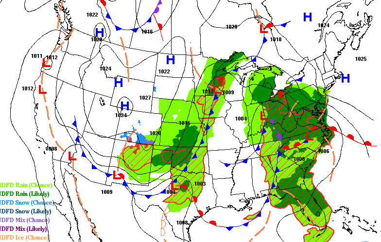
Below normal temperatures to start the week with a midweek warm up. We’re watching a developing late week storm that will bring rain and snow late Thursday into Friday to Minnesota.
Weekend snow across much of Minnesota — including more than 18 inches along parts of the North Shore — continued to have effects on roads and schools on Monday.
We start the week chillier behind the weekend storm system. Highs will be in the 20s to low 30s Monday, more than 10 degrees below normal for some. We have a midweek warm up then a potential big storm Thursday into Friday.
We’ll see some snow at times Sunday and Sunday evening, with the highest snow totals in northeastern Minnesota and northern Wisconsin. Cool temps to start the week, then warmer by Wednesday.
Snow continues Saturday evening and into Saturday night. Some areas will also see accumulating snow on Sunday. We have the updated snow forecast and a fresh look at warnings and advisories.
The snow will continue into late Saturday night and Sunday in northern Minnesota and northwestern Wisconsin, with intermittent snow possible Sunday in central and southern Minnesota and west-central Wisconsin.
Our snowy winter continues. We have an update on expected weekend snow totals. Warnings and advisories have been posted for many areas Saturday into Sunday.
When it comes to staying informed in Minnesota, our newsletters overdeliver. Sign-up now for headlines, breaking news, hometown stories, weather and much more. Delivered weekday mornings.