We’ll have scattered snow showers statewide still Friday but generally, they’ll be lighter. Temperatures will still be mild ranging from the low 30s to the upper 20s. Colder air moves in for the weekend and next week.
It snows every year in Minnesota, but there’s something about the first statewide storm that brings us all together. Check out these photos from listeners.
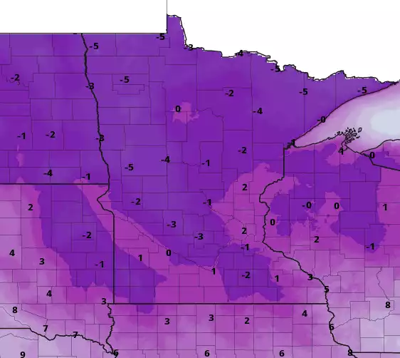
Our massive, lollygagging, dayslong storm is finally beginning to wind down across Minnesota. Next week brings a bitterly cold air mass that will likely be the state’s first prolonged subzero stretch of the cold season.
Snow continues to affect travel. We have updated warnings and advisories, plus a look at snow totals. Quieter and colder weather is on tap for the weekend.
Snow emergencies have been declared in Minneapolis and St. Paul, so check where your car is parked. Periods of snow continue Thursday with the heaviest snowfall shifting north and west.
Heavy snow continued to fall across much of Minnesota on Thursday, with ongoing blizzard conditions near Lake Superior and snow totals of more than 2 feet in some communities.
Most of the intense winter weather will be in northeast Minnesota Wednesday as heavy snow and high winds of up to 40-45 mph blow. Blizzard warnings continue for the North Shore. Snow returns statewide Wednesday night into Friday.
When it comes to staying informed in Minnesota, our newsletters overdeliver. Sign-up now for headlines, breaking news, hometown stories, weather and much more. Delivered weekday mornings.