Light snow sweeps across much of Minnesota Friday morning. Highs will be in the teens in southern Minnesota and single digits in the north. Temperatures will be much warmer Saturday. The really warm stuff arrives next week.
It’s cold again Friday morning but readings are a far improvement from Thursday morning. Light snow is pushing through the state as well and could create slick spots. Temperatures are cold enough where most road chemicals work slowly or not at all.
Most of southern Minnesota will see Saturday highs in the 30s, with 20s and a few upper teens in northern Minnesota. We have your weekend forecast details, including some snow chances.
A tribute to a Golden Girl will soon grace an orange truck clearing snow and ice from Minnesota highways. "Betty Whiteout" is the runaway winner in this winter's MnDOT Name-A-Snowplow contest.
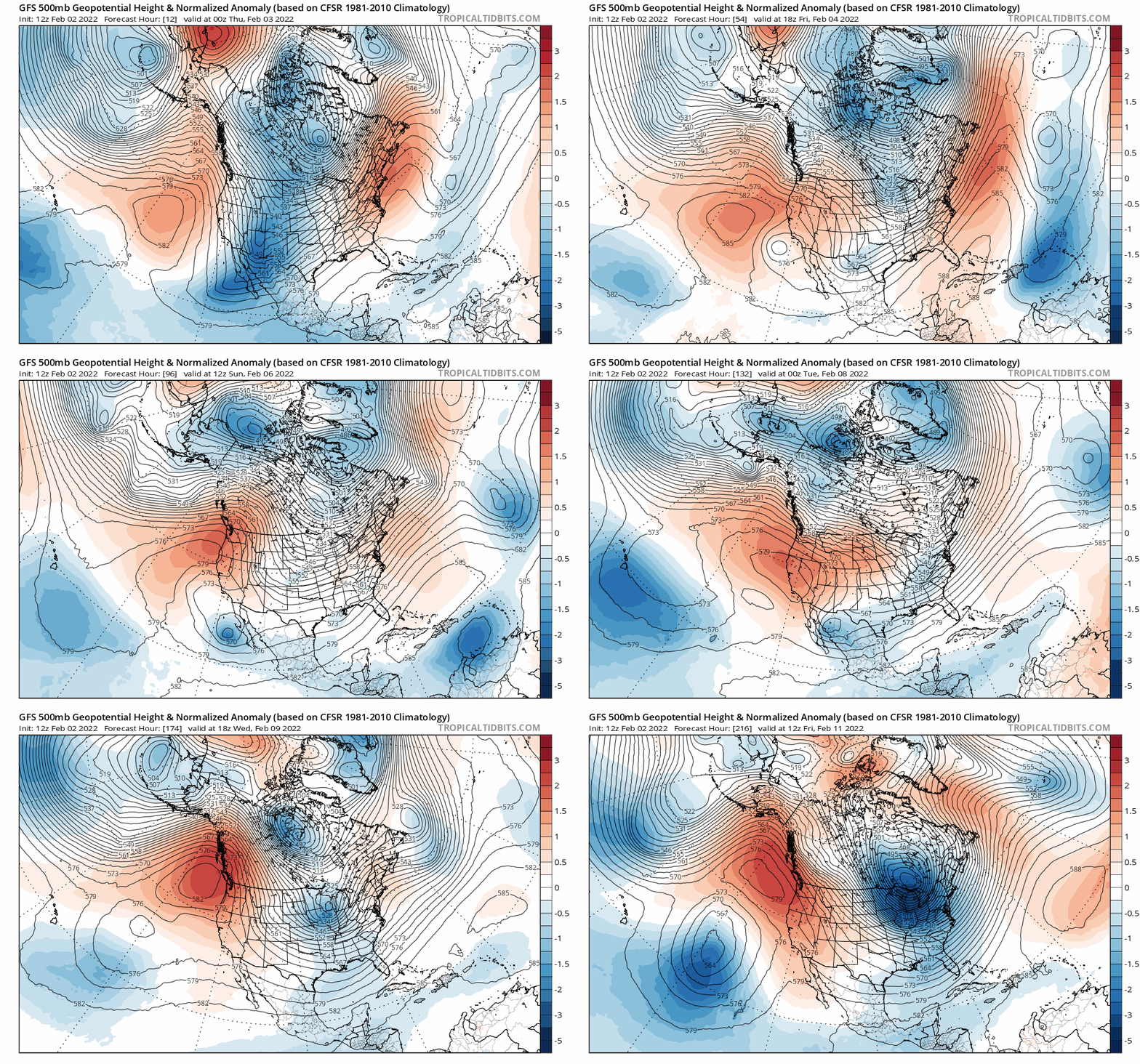
Subzero weather continues across much of Minnesota Thursday and overnight. Friday brings highs in the teens for most of Minnesota. Highs Saturday will be in the 30s in the south, 20s in the north. Highs by Tuesday could reach 40 degrees in the Twin Cities.
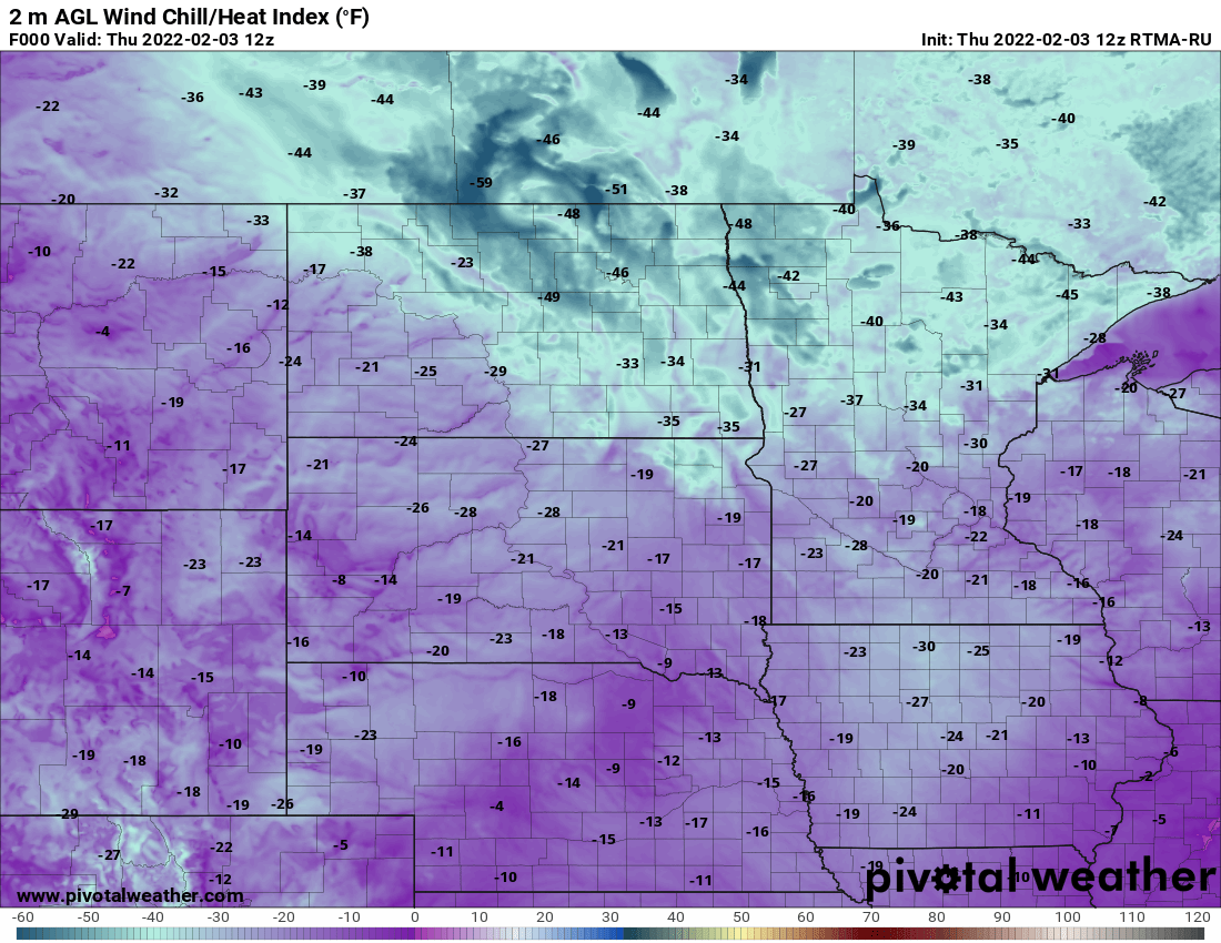
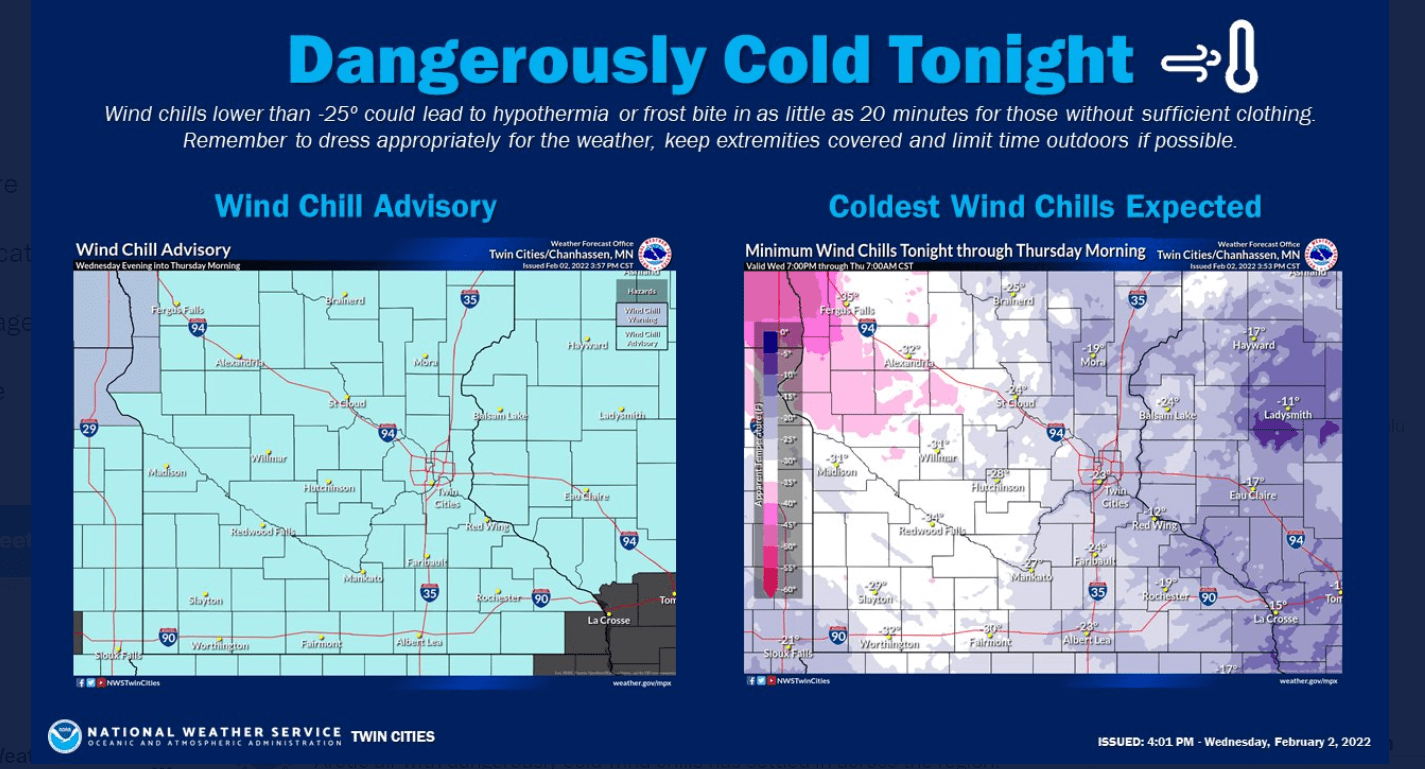
It’s (yet another) dangerously cold morning across the region early Thursday. Wind chills are as cold as 50 below zero in northwest Minnesota. Wind chills in eastern Minnesota are mainly in the minus 20s where skin can still freeze in 15 minutes.
When it comes to staying informed in Minnesota, our newsletters overdeliver. Sign-up now for headlines, breaking news, hometown stories, weather and much more. Delivered weekday mornings.