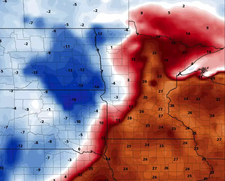
After some Friday evening flakes, much of the weekend will be dry. Monday could bring a mix of rain and snow. We have details on that, plus temperature trends and the updated spring flooding outlook.
Friday will be nearly 20 degrees colder than normal with highs ranging from the low teens southeast to subzero northwest. A brief shot of light snow moves through late Friday evening with a messier system Monday.
Most of Minnesota is seeing subzero temperatures early Friday with high temperatures that will run about 20 degrees below the average in the teens and single digits. Temps warm up this weekend with rain, snow possible Monday.
This latest snow blitz puts the Twin Cities at 73.5 inches so far this season, less than 5 inches shy of the Top 10 snowiest winters on record — and it’s still February. The region is a little more than 2 feet from the all-time record of 98.6 inches set in 1983-84.
Every year, north Minneapolis resident Paul Skrbec invites neighbors with snowblowers to join his “snowblower challenge:” Go a little farther and clear sidewalks for the whole block.
A winter storm disrupted school, work and travel in Minnesota this week. MPR News host Angela Davis checked in with MPR News reporters, state officials and drivers for the latest conditions around the state.
Parts of northern Minnesota and western Wisconsin will see more accumulating snow through much of Thursday afternoon. Temps will plummet Thursday night into Friday. Forecast highs will reach the 30s on Sunday in many areas, including the Twin Cities.
When it comes to staying informed in Minnesota, our newsletters overdeliver. Sign-up now for headlines, breaking news, hometown stories, weather and much more. Delivered weekday mornings.