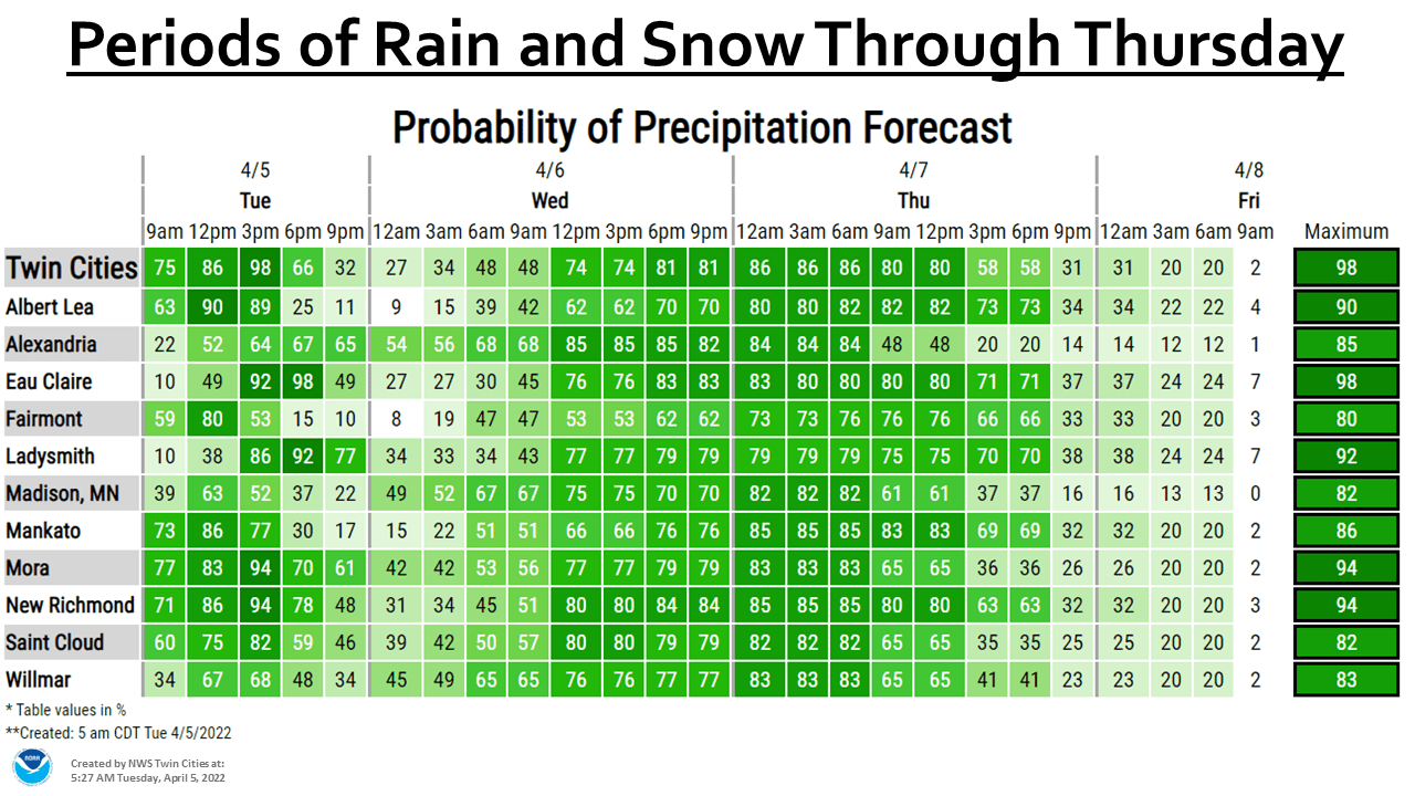
Our weekend will feature cold temps and plenty of sunshine. Some spots will see flakes Saturday evening. And we have an update on our Thursday snow potential.
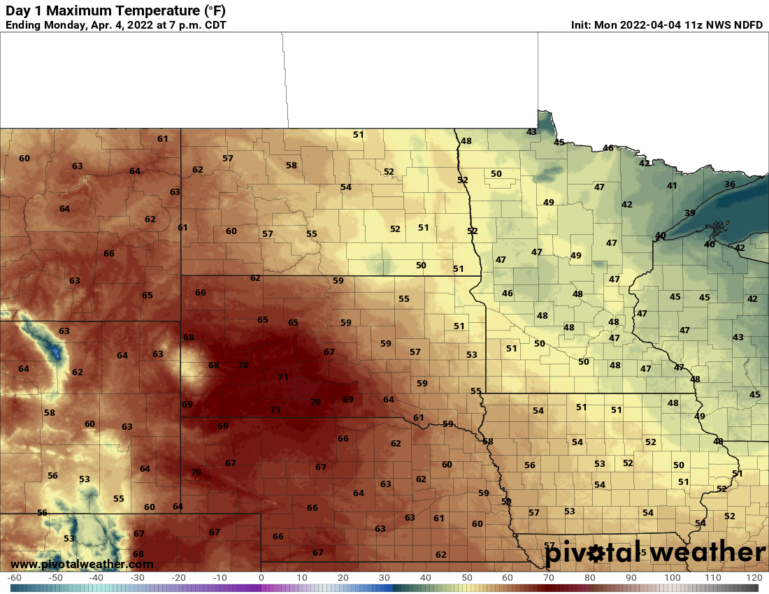
Temperatures warm into Thursday evening, moving from mostly single digits and teens to the 30s for the southern half of Minnesota. By early Saturday morning, most of Minnesota will be back below zero.
Despite a cooler start early Thursday, temperatures will rapidly warm late as a clipper system brings snow and above freezing temperatures by evening with the possibility of light rain overnight Thursday night. It will be another windy day as well.
Temperatures will cool slowly Wednesday and winds will make it feel cooler. Expect temperatures in the 30s with wind chills in the 20s in Southern Minnesota. Northern Minnesota will see temps drop into the teens and 20s with single-digit wind chills.
Temperatures in the 30s are a bit above normal for high temperatures even on Feb. 9. We won’t see a lot of movement Wednesday as a strong northwest wind keeps temperatures in check. We’ll still be in the low 30s from the Twin Cities south and 20s north.
When it comes to staying informed in Minnesota, our newsletters overdeliver. Sign-up now for headlines, breaking news, hometown stories, weather and much more. Delivered weekday mornings.