Scattered showers will develop Thursday for portions of central and southern Minnesota. Heavier rain and storms are possible Friday into Saturday. Drier weather develops next week.
The National Weather Service had issued heat advisories for parts of at least 15 states, including in several major cities such as Philadelphia, Columbus and Boston.
Torrential rains flooded streets and basements across the Iron Range and washed out some local roads. More than 6 inches of rain swelled the Baptism River along Lake Superior's North Shore, flooding trails and destroying a bridge at Tettegouche State Park.
It’ll be cooler and considerably less humid Wednesday. Some showers will linger in southeast Minnesota, but most will be dry before more rain develops for southern Minnesota Thursday.
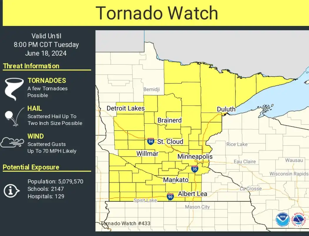
Expect strong to severe storms to move east across Minnesota Tuesday afternoon and evening. The most likely window for storms in the greater Twin Cities is between 5 and 8 p.m.
Rivers across southern Minnesota continued rising Tuesday, leading to highway closures — with more rain in the forecast. Meanwhile, a line of strong storms swept across northern Minnesota, with more storms possible later Tuesday.
When it comes to staying informed in Minnesota, our newsletters overdeliver. Sign-up now for headlines, breaking news, hometown stories, weather and much more. Delivered weekday mornings.