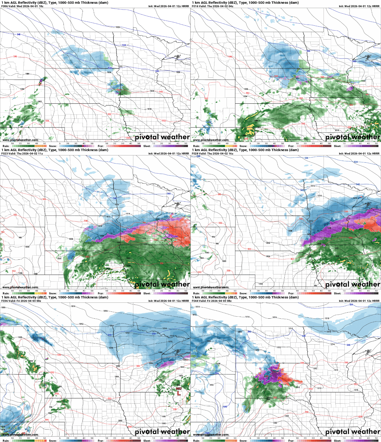
A late-season winter storm brought a mix of snow, sleet and freezing rain to much of Minnesota on Thursday. That prompted some school districts to change plans for the day.
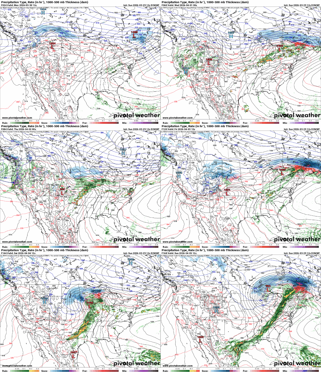
Clouds increase Wednesday, then rain and snow develop later Wednesday into Wednesday night when we’ll see a wintry mix. Wintry precipitation continues into Thursday with another system Friday into Saturday.
Two wintry storms bring the potential for heavy snow in the northern half of Minnesota. Rain and a wintry mix of sleet and freezing rain are possible in the central and south.
Active weather continues after system No. 1 exits this morning. More rain, ice and snow are possible late Wednesday into Thursday and Friday into Saturday.
With April and severe weather season on the horizon in Minnesota, understanding the national Storm Prediction Center’s severe weather risk levels can make all the difference, from isolated storms to high-risk outbreaks. Let’s break down each risk level and what it means for you.
The week starts warm Monday but then things get active. We’re watching three different storm systems that will bring chances of rain, thunder and snow this week.
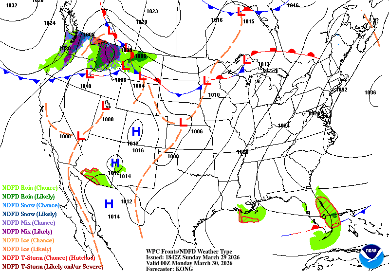
Minnesota will be split in two to start the week, as a nearly stationary front separates warm air from cooler conditions north while bringing increasing chances for showers and thunderstorms.
Spring weather settles in Sunday into Monday with lighter winds and warming temperatures, but a nearly stalled front will bring increasing chances for precipitation and possible thunderstorms by Monday.
When it comes to staying informed in Minnesota, our newsletters overdeliver. Sign-up now for headlines, breaking news, hometown stories, weather and much more. Delivered weekday mornings.